 |
|
| Skypark Airport |
| IATA: BTF – ICAO: KBTF – FAA LID: BTF |
| Summary |
| Airport type |
Public |
| Owner |
Skypark Airport Assoc., LLC |
| Serves |
Bountiful, Utah |
| Elevation AMSL |
4,234 ft / 1,291 m |
| Coordinates |
40°52′10″N 111°55′38″W / 40.86944°N 111.92722°W / 40.86944; -111.92722 |
| Runways |
| Direction |
Length |
Surface |
| ft |
m |
| 16/34 |
4,700 |
1,433 |
Asphalt |
| Statistics (2007) |
| Aircraft operations |
75,912 |
| Based aircraft |
225 |
| Source: Federal Aviation Administration |
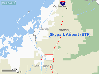
Skypark Airport (IATA: BTF, ICAO: KBTF, FAA LID: BTF) is a public use airport located three nautical miles (6 km) southwest of the central business district of Bountiful, a city in Davis County, Utah, United States. It is privately owned by Skypark Airport Assoc., LLC.
Facilities and aircraft
Skypark Airport covers an area of 35 acres (14 ha) at an elevation of 4,234 feet (1,291 m) above mean sea level. It has one asphalt paved runway designated 16/34 which measures 4,700 by 70 feet (1,433 x 21 m).
For the 12-month period ending December 31, 2007, the airport had 75,912 aircraft operations, an average of 207 per day: 99.8% general aviation and 0.2% air taxi. At that time there were 225 aircraft based at this airport: 87% single-engine, 8% multi-engine and 5% helicopter.
The above content comes from Wikipedia and is published under free licenses – click here to read more.
Location & QuickFacts
| FAA Information Effective: | 2008-09-25 |
| Airport Identifier: | BTF |
| Airport Status: | Operational |
| Longitude/Latitude: | 111-55-37.7800W/40-52-09.8010N
-111.927161/40.869389 (Estimated) |
| Elevation: | 4234 ft / 1290.52 m (Estimated) |
| Land: | 35 acres |
| From nearest city: | 3 nautical miles SW of Bountiful, UT |
| Location: | Davis County, UT |
| Magnetic Variation: | 15E (1985) |
Owner & Manager
| Ownership: | Privately owned |
| Owner: | Skypark Airport Assoc, Llc |
| Address: | 1887 S. 1800 W. #2
Woods Cross, UT 84087 |
| Phone number: | 801-292-8188 |
| Manager: | Mel Rosema |
| Address: | 1887 S. 1800 W.
Woods Cross, UT 84087 |
| Phone number: | (801) 298-5970 |
Airport Operations and Facilities
| Airport Use: | Open to public |
| Wind indicator: | Yes |
| Segmented Circle: | No |
| Control Tower: | No |
| Lighting Schedule: | DUSK-DAWN
ACTVT LIRL RY 16/34 - CTAF. VASI RYS 16 & 34 OPER 24 HRS. |
| Beacon Color: | Clear-Green (lighted land airport) |
| Landing fee charge: | No |
| Sectional chart: | Salt Lake City |
| Region: | ANM - Northwest Mountain |
| Traffic Pattern Alt: | 800 ft |
| Boundary ARTCC: | ZLC - Salt Lake City |
| Tie-in FSS: | CDC - Cedar City |
| FSS on Airport: | No |
| FSS Toll Free: | 1-800-WX-BRIEF |
| NOTAMs Facility: | CDC (NOTAM-d service avaliable) |
Airport Communications
| CTAF: | 122.800 |
| Unicom: | 122.800 |
Airport Services
| Fuel available: | 100LLA
SELF SERVICE FUEL AVAILABLE 24 HRS WITH CREDIT CARD. |
| Airframe Repair: | MAJOR |
| Power Plant Repair: | MAJOR |
| Bulk Oxygen: | NONE |
Runway Information
Runway 16/34
| Dimension: | 4700 x 70 ft / 1432.6 x 21.3 m |
| Surface: | ASPH, Good Condition |
| Weight Limit: | Single wheel: 12500 lbs. |
| Edge Lights: | Low |
| |
Runway 16 |
Runway 34 |
| Traffic Pattern: | Left | Right |
| Markings: | Basic, Good Condition | Basic, Good Condition |
| Crossing Height: | 11.00 ft | 11.00 ft |
| Displaced threshold: | 390.00 ft | 385.00 ft |
| VASI: | 2-box on left side | 2-box on left side |
| Visual Glide Angle: | 3.00° | 3.00° |
| Obstruction: | 25 ft tank, 424.0 ft from runway, 225 ft right of centerline, 8:1 slope to clear
APCH SLOPE 34:1 TO DSPLCD THLD.
RY 16 +12 FT ROAD 48 FT FM RY END, +4 FT FENCE 15 FT FM RY END. | 28 ft tree, 252.0 ft from runway, 65 ft left of centerline, 1:1 slope to clear
APCH SLOPE 22:1 TO DSPLCD THLD.
RY 34 +2 FT BAR 33 FT FM RY END, +18 FT ROAD & TREE 54 FT FM RY END. |
|
Radio Navigation Aids
| ID |
Type |
Name |
Ch |
Freq |
Var |
Dist |
| TVY | NDB | Tooele | | 371.00 | 13E | 24.7 nm |
| BMC | NDB | Brigham City | | 294.00 | 16E | 39.5 nm |
| HIF | TACAN | Hill | 049X | | 14E | 15.2 nm |
| PVU | VOR/DME | Provo | 021X | 108.40 | 15E | 40.4 nm |
| EVW | VOR/DME | Evanston | 33X | 109.60 | 13E | 46.7 nm |
| TCH | VORTAC | Wasatch | 115X | 116.80 | 16E | 2.7 nm |
| OGD | VORTAC | Ogden | 104X | 115.70 | 14E | 22.7 nm |
| FFU | VORTAC | Fairfield | 113X | 116.60 | 16E | 35.7 nm |
| SLC | VOT | Salt Lake City | | 111.00 | | 15.2 nm |
Images and information placed above are from
http://www.airport-data.com/airport/BTF/
We thank them for the data!
| General Info
|
| Country |
United States
|
| State |
UTAH
|
| FAA ID |
BTF
|
| Latitude |
40-52-09.801N
|
| Longitude |
111-55-37.780W
|
| Elevation |
4234 feet
|
| Near City |
BOUNTIFUL
|
We don't guarantee the information is fresh and accurate. The data may
be wrong or outdated.
For more up-to-date information please refer to other sources.
|
|


