 |
|
Location & QuickFacts
| FAA Information Effective: | 2008-09-25 |
| Airport Identifier: | UT02 |
| Airport Status: | Operational |
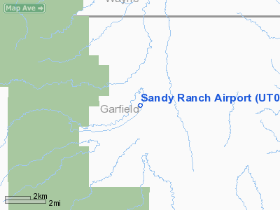
| Longitude/Latitude: | 111-04-02.5860W/38-05-19.9420N
-111.067385/38.088873 (Estimated) |
| Elevation: | 5468 ft / 1666.65 m (Estimated) |
| Land: | 9 acres |
| From nearest city: | 21 nautical miles SE of Torrey, UT |
| Location: | Wayne County, UT |
| Magnetic Variation: | 14E (1985) |
Owner & Manager
| Ownership: | Privately owned |
| Owner: | Tercero Corp |
| Address: | 4400 One Williams Center
Tulsa, OK 74172-0144 |
| Phone number: | 801-425-3282 |
| Manager: | Steve Dalton |
| Address: | Po Box 129
Torrey, UT 84775 |
Airport Operations and Facilities
| Airport Use: | Private |
| Wind indicator: | Yes |
| Segmented Circle: | No |
| Control Tower: | No |
| Sectional chart: | Las Vegas |
| Region: | ANM - Northwest Mountain |
| Boundary ARTCC: | ZLC - Salt Lake City |
| Tie-in FSS: | CDC - Cedar City |
| FSS Toll Free: | 1-800-WX-BRIEF |
Runway Information
Runway 02/20
| Dimension: | 3700 x 100 ft / 1127.8 x 30.5 m |
| Surface: | TURF, |
| |
Runway 02 |
Runway 20 |
| Traffic Pattern: | Left | Left |
| Obstruction: | | 15 ft trees, 100.0 ft from runway |
|
Radio Navigation Aids
| ID |
Type |
Name |
Ch |
Freq |
Var |
Dist |
| HVE | VORTAC | Hanksville | 106X | 115.90 | 15E | 26.3 nm |
Remarks
- OWNER DESIRES ARPT NOT TO BE CHARTED.
Images and information placed above are from
http://www.airport-data.com/airport/UT02/
We thank them for the data!
| General Info
|
| Country |
United States
|
| State |
UTAH
|
| FAA ID |
UT02
|
| Latitude |
38-05-19.942N
|
| Longitude |
111-04-02.586W
|
| Elevation |
5468 feet
|
| Near City |
TORREY
|
We don't guarantee the information is fresh and accurate. The data may
be wrong or outdated.
For more up-to-date information please refer to other sources.
|
|


