 |
|
| Salina-Gunnison Airport |
| IATA: SBO – ICAO: none – FAA LID: 44U |
| Summary |
| Airport type |
Public |
| Owner |
Cities of Salina & Gunnison |
| Serves |
Salina & Gunnison, Utah |
| Location |
Sevier County |
| Elevation AMSL |
5,159 ft / 1,572 m |
| Coordinates |
39°01′45″N 111°50′18″W / 39.02917°N 111.83833°W / 39.02917; -111.83833 |
| Runways |
| Direction |
Length |
Surface |
| ft |
m |
| 2/20 |
3,855 |
1,175 |
Asphalt |
| Statistics (2007) |
| Aircraft operations |
1,325 |
| Based aircraft |
7 |
| Source: Federal Aviation Administration |
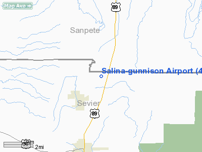
Salina-Gunnison Airport (IATA: SBO, FAA LID: 44U) is a public-use airport located five nautical miles (9 km) northeast of the central business district of Salina, a city in Sevier County, Utah, United States. It is owned by the cities of Salina and Gunnison.
Facilities and aircraft
Salina-Gunnison Airport covers an area of 610 acres (247 ha) at an elevation of 5,159 feet (1,572 m) above mean sea level. It has one asphalt paved runway designated 2/20 which measures 3,855 by 60 feet (1,175 x 18 m). For the 12-month period ending December 31, 2007, the airport had 2,052 aircraft operations, all of which were general aviation. At that time, there were 7 aircraft based at the airport, all single-engine.
The above content comes from Wikipedia and is published under free licenses – click here to read more.
Location & QuickFacts
| FAA Information Effective: | 2008-09-25 |
| Airport Identifier: | 44U |
| Airport Status: | Operational |
| Longitude/Latitude: | 111-50-17.7300W/39-01-44.8620N
-111.838258/39.029128 (Estimated) |
| Elevation: | 5159 ft / 1572.46 m (Estimated) |
| Land: | 610 acres |
| From nearest city: | 5 nautical miles NE of Salina, UT |
| Location: | Sevier County, UT |
| Magnetic Variation: | 14E (1985) |
Owner & Manager
| Ownership: | Publicly owned |
| Owner: | Cities Of Salina & Gunnision |
| Address: | P.o. Box 790
Gunnision, UT 84634 |
| Phone number: | 435-528-7969 |
| Manager: | Richard Nay |
| Address: | P.o. Box 790
Gunnison, UT 84634 |
| Phone number: | 435-528-7136 |
Airport Operations and Facilities
| Airport Use: | Open to public |
| Wind indicator: | Yes |
| Segmented Circle: | No |
| Control Tower: | No |
| Lighting Schedule: | DUSK-DAWN
ACTVT MIRL RY 02/20 - CTAF. |
| Beacon Color: | Clear-Green (lighted land airport)
BCN OTS INDEFLY. |
| Landing fee charge: | No |
| Sectional chart: | Las Vegas |
| Region: | ANM - Northwest Mountain |
| Boundary ARTCC: | ZLC - Salt Lake City |
| Tie-in FSS: | CDC - Cedar City |
| FSS on Airport: | No |
| FSS Toll Free: | 1-800-WX-BRIEF |
| NOTAMs Facility: | CDC (NOTAM-d service avaliable) |
| Federal Agreements: | 1 |
Airport Communications
Airport Services
| Airframe Repair: | NONE |
| Power Plant Repair: | NONE |
| Bottled Oxygen: | NONE |
| Bulk Oxygen: | NONE |
Runway Information
Runway 02/20
| Dimension: | 3855 x 60 ft / 1175.0 x 18.3 m |
| Surface: | ASPH, Fair Condition |
| Weight Limit: | Single wheel: 6000 lbs. |
| Edge Lights: | Medium |
| |
Runway 02 |
Runway 20 |
| Longitude: | 111-50-32.0700W | 111-50-02.4600W |
| Latitude: | 39-01-29.3500N | 39-01-59.6600N |
| Alignment: | 36 | 127 |
| Traffic Pattern: | Left | Left |
| Markings: | Basic, Fair Condition | Basic, Fair Condition |
|
Radio Navigation Aids
| ID |
Type |
Name |
Ch |
Freq |
Var |
Dist |
| DTA | VORTAC | Delta | 108X | 116.10 | 16E | 35.2 nm |
Remarks
Images and information placed above are from
http://www.airport-data.com/airport/44U/
We thank them for the data!
| General Info
|
| Country |
United States
|
| State |
UTAH
|
| FAA ID |
44U
|
| Latitude |
39-01-44.862N
|
| Longitude |
111-50-17.730W
|
| Elevation |
5159 feet
|
| Near City |
SALINA
|
We don't guarantee the information is fresh and accurate. The data may
be wrong or outdated.
For more up-to-date information please refer to other sources.
|
|


