 |
|
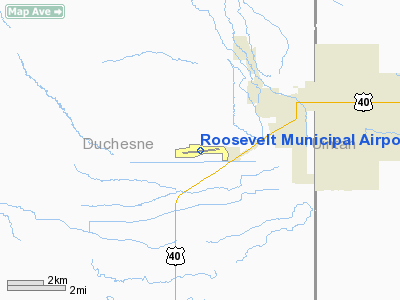
Location & QuickFacts
| FAA Information Effective: | 2008-09-25 |
| Airport Identifier: | 74V |
| Airport Status: | Operational |
| Longitude/Latitude: | 110-03-04.5430W/40-16-41.8500N
-110.051262/40.278292 (Estimated) |
| Elevation: | 5172 ft / 1576.43 m (Estimated) |
| Land: | 208 acres |
| From nearest city: | 3 nautical miles SW of Roosevelt, UT |
| Location: | Duchesne County, UT |
| Magnetic Variation: | 15E (1975) |
Owner & Manager
| Ownership: | Publicly owned |
| Owner: | City Of Roosevelt |
| Address: | 255 S. State St.
Roosevelt, UT 84066 |
| Phone number: | 435-722-5001 |
| Manager: | Justin Johnson |
| Address: | 255 S. State St.
Roosevelt, UT 84066 |
| Phone number: | 435-722-5001 |
Airport Operations and Facilities
| Airport Use: | Open to public |
| Wind indicator: | Yes |
| Segmented Circle: | Yes |
| Control Tower: | No |
| Lighting Schedule: | DUSK-DAWN
ACTVT MIRL RY 07/25, PAPI RYS 07&25 & REIL RYS 07&25 CTAF. |
| Beacon Color: | Clear-Green (lighted land airport) |
| Landing fee charge: | No |
| Sectional chart: | Salt Lake City |
| Region: | ANM - Northwest Mountain |
| Boundary ARTCC: | ZLC - Salt Lake City |
| Tie-in FSS: | CDC - Cedar City |
| FSS on Airport: | No |
| FSS Toll Free: | 1-800-WX-BRIEF |
| NOTAMs Facility: | CDC (NOTAM-d service avaliable) |
| Federal Agreements: | NGY |
Airport Communications
| CTAF: | 122.800 |
| Unicom: | 122.800 |
Airport Services
| Fuel available: | 100LLA
FUEL AVAILABLE WITH CREDIT CARD. |
| Airframe Repair: | MAJOR |
| Power Plant Repair: | MAJOR |
| Bottled Oxygen: | NONE |
| Bulk Oxygen: | NONE |
Runway Information
Runway 07/25
| Dimension: | 6500 x 75 ft / 1981.2 x 22.9 m |
| Surface: | ASPH, Fair Condition |
| Weight Limit: | Single wheel: 12000 lbs. |
| Edge Lights: | Medium |
| |
Runway 07 |
Runway 25 |
| Longitude: | 110-03-46.5400W | 110-02-23.3200W |
| Latitude: | 40-16-37.8500N | 40-16-45.7800N |
| Elevation: | 5172.00 ft | 5104.00 ft |
| Alignment: | 83 | 127 |
| Traffic Pattern: | Left | Left |
| Markings: | Non-precision instrument, Fair Condition | Basic, Fair Condition |
| Crossing Height: | 40.00 ft | 40.00 ft |
| VASI: | 2-light PAPI on left side | 2-light PAPI on left side |
| Visual Glide Angle: | 3.00° | 3.00° |
| Runway End Identifier: | Yes | Yes |
|
Radio Navigation Aids
| ID |
Type |
Name |
Ch |
Freq |
Var |
Dist |
| VEL | VOR/DME | Vernal | 019X | 108.20 | 15E | 26.3 nm |
| MTU | VORTAC | Myton | 074X | 112.70 | 14E | 8.5 nm |
Images and information placed above are from
http://www.airport-data.com/airport/74V/
We thank them for the data!
| General Info
|
| Country |
United States
|
| State |
UTAH
|
| FAA ID |
74V
|
| Latitude |
40-16-41.850N
|
| Longitude |
110-03-04.543W
|
| Elevation |
5172 feet
|
| Near City |
ROOSEVELT
|
We don't guarantee the information is fresh and accurate. The data may
be wrong or outdated.
For more up-to-date information please refer to other sources.
|
|


