 |
|
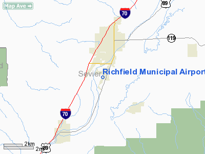
Location & QuickFacts
| FAA Information Effective: | 2008-09-25 |
| Airport Identifier: | RIF |
| Airport Status: | Operational |
| Longitude/Latitude: | 112-05-56.2000W/38-44-11.1700N
-112.098944/38.736436 (Estimated) |
| Elevation: | 5301 ft / 1615.74 m (Surveyed) |
| Land: | 233 acres |
| From nearest city: | 1 nautical miles SW of Richfield, UT |
| Location: | Sevier County, UT |
| Magnetic Variation: | 13E (2000) |
Owner & Manager
| Ownership: | Publicly owned |
| Owner: | City Of Richfield |
| Address: | 75 E. Center, P.o. Box 250
Richfield, UT 84701 |
| Phone number: | 435-896-6439 |
| Manager: | Rowena Hulet |
| Address: | 1615 South Airport Rd, Po Box 191
Richfield, UT 84701-0191 |
| Phone number: | 435-896-9413 |
Airport Operations and Facilities
| Airport Use: | Open to public |
| Wind indicator: | Yes |
| Segmented Circle: | Yes |
| Control Tower: | No |
| Lighting Schedule: | DUSK-DAWN
ACTVT MIRL RY 01/19 - CTAF. |
| Beacon Color: | Clear-Green (lighted land airport) |
| Landing fee charge: | No |
| Sectional chart: | Las Vegas |
| Region: | ANM - Northwest Mountain |
| Boundary ARTCC: | ZLC - Salt Lake City |
| Tie-in FSS: | CDC - Cedar City |
| FSS on Airport: | No |
| FSS Toll Free: | 1-800-WX-BRIEF |
| NOTAMs Facility: | CDC (NOTAM-d service avaliable) |
| Federal Agreements: | NGY |
Airport Communications
| CTAF: | 122.800 |
| Unicom: | 122.800 |
Airport Services
| Fuel available: | 100LLA
FOR FUEL AFTER HOURS CALL 435-896-8918 OR 435-896-3053 |
| Airframe Repair: | MAJOR |
| Power Plant Repair: | MAJOR |
| Bottled Oxygen: | NONE |
Runway Information
Runway 01/19
| Dimension: | 6600 x 75 ft / 2011.7 x 22.9 m |
| Surface: | ASPH, Fair Condition |
| Weight Limit: | Single wheel: 19000 lbs. |
| Edge Lights: | Medium |
| |
Runway 01 |
Runway 19 |
| Longitude: | 112-06-13.8200W | 112-05-38.6400W |
| Latitude: | 38-43-41.6200N | 38-44-40.7400N |
| Elevation: | 5301.00 ft | 5274.00 ft |
| Alignment: | 25 | 127 |
| Traffic Pattern: | Right | Left |
| Markings: | Non-precision instrument, Fair Condition | Non-precision instrument, Fair Condition |
| VASI: | 2-light PAPI on left side | 2-light PAPI on left side |
| Visual Glide Angle: | 3.50° | 3.50° |
| Obstruction: | 75 ft tree, 2120.0 ft from runway, 304 ft right of centerline, 25:1 slope to clear | 45 ft pole, 2000.0 ft from runway, 481 ft left of centerline, 40:1 slope to clear |
|
Radio Navigation Aids
| ID |
Type |
Name |
Ch |
Freq |
Var |
Dist |
| DTA | VORTAC | Delta | 108X | 116.10 | 16E | 39.0 nm |
| MLF | VORTAC | Milford | 058X | 112.10 | 16E | 48.6 nm |
Images and information placed above are from
http://www.airport-data.com/airport/RIF/
We thank them for the data!
| General Info
|
| Country |
United States
|
| State |
UTAH
|
| FAA ID |
RIF
|
| Latitude |
38-44-11.170N
|
| Longitude |
112-05-56.200W
|
| Elevation |
5301 feet
|
| Near City |
RICHFIELD
|
We don't guarantee the information is fresh and accurate. The data may
be wrong or outdated.
For more up-to-date information please refer to other sources.
|
|


