 |
|
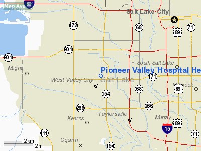
Pioneer Valley Hospital Heliport |
Location & QuickFacts
| FAA Information Effective: | 2008-09-25 |
| Airport Identifier: | UT23 |
| Airport Status: | Operational |
| Longitude/Latitude: | 111-59-22.7790W/40-41-59.8070N
-111.989661/40.699946 (Estimated) |
| Elevation: | 4251 ft / 1295.70 m (Estimated) |
| Land: | 0 acres |
| From nearest city: | 2 nautical miles N of West Valley City, UT |
| Location: | Salt Lake County, UT |
| Magnetic Variation: | 14E (1990) |
Owner & Manager
| Ownership: | Privately owned |
| Owner: | Pioneer Valley Hospital |
| Address: | 3460 S. Pioneer Parkway
West Valley City, UT 84120 |
| Phone number: | 801-964-3100 |
| Manager: | Cole Julian |
| Address: | 3460 S. Pioneer Parkway
West Valley City, UT 84120 |
| Phone number: | 801-964-3100 |
Airport Operations and Facilities
| Airport Use: | Private
MEDICAL. |
| Wind indicator: | Yes |
| Segmented Circle: | No |
| Control Tower: | No |
| Lighting Schedule: | PHONE REQ
FOR PERIMETER LGTS CALL 801-964-3100. |
| Sectional chart: | Salt Lake City |
| Region: | ANM - Northwest Mountain |
| Boundary ARTCC: | ZLC - Salt Lake City |
| Tie-in FSS: | CDC - Cedar City |
| FSS on Airport: | No |
| FSS Toll Free: | 1-800-WX-BRIEF |
Runway Information
Helipad H1
| Dimension: | 80 x 80 ft / 24.4 x 24.4 m |
| Surface: | ASPH, Good Condition |
| |
Runway H1 |
Runway |
| Traffic Pattern: | Left | Left |
|
Radio Navigation Aids
| ID |
Type |
Name |
Ch |
Freq |
Var |
Dist |
| TVY | NDB | Tooele | | 371.00 | 13E | 17.2 nm |
| BMC | NDB | Brigham City | | 294.00 | 16E | 49.2 nm |
| HIF | TACAN | Hill | 049X | | 14E | 25.3 nm |
| PVU | VOR/DME | Provo | 021X | 108.40 | 15E | 31.6 nm |
| TCH | VORTAC | Wasatch | 115X | 116.80 | 16E | 9.0 nm |
| FFU | VORTAC | Fairfield | 113X | 116.60 | 16E | 25.6 nm |
| OGD | VORTAC | Ogden | 104X | 115.70 | 14E | 31.9 nm |
| SLC | VOT | Salt Lake City | | 111.00 | | 4.8 nm |
Remarks
- PRVDD 8:1 APCH/DEP SLOPES ARE ESTABLISHED & MAINTAINED.
Images and information placed above are from
http://www.airport-data.com/airport/UT23/
We thank them for the data!
| General Info
|
| Country |
United States
|
| State |
UTAH
|
| FAA ID |
UT23
|
| Latitude |
40-41-59.807N
|
| Longitude |
111-59-22.779W
|
| Elevation |
4251 feet
|
| Near City |
WEST VALLEY CITY
|
We don't guarantee the information is fresh and accurate. The data may
be wrong or outdated.
For more up-to-date information please refer to other sources.
|
|


