 |
|
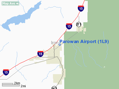
Location & QuickFacts
| FAA Information Effective: | 2008-09-25 |
| Airport Identifier: | 1L9 |
| Airport Status: | Operational |
| Longitude/Latitude: | 112-48-57.7980W/37-51-34.9090N
-112.816055/37.859697 (Estimated) |
| Elevation: | 5930 ft / 1807.46 m (Estimated) |
| Land: | 118 acres |
| From nearest city: | 1 nautical miles NE of Parowan, UT |
| Location: | Iron County, UT |
| Magnetic Variation: | 14E (1985) |
Owner & Manager
| Ownership: | Publicly owned |
| Owner: | City Of Parowan |
| Address: | 5 South Main St, Po Box 576
Parowan, UT 84761 |
| Phone number: | 435-477-3331 |
| Manager: | Dave Norwood |
| Address: | P.o. Box 667
Parowan, UT 84761 |
| Phone number: | 435-477-8911 |
Airport Operations and Facilities
| Airport Use: | Open to public |
| Wind indicator: | Yes |
| Segmented Circle: | Yes |
| Control Tower: | No |
| Lighting Schedule: | DUSK-DAWN
ACTVT MIRL RY 04/22, PAPI AND REIL RYS 04 AND 22 - CTAF. |
| Beacon Color: | Clear-Green (lighted land airport) |
| Landing fee charge: | No |
| Sectional chart: | Las Vegas |
| Region: | ANM - Northwest Mountain |
| Boundary ARTCC: | ZLC - Salt Lake City |
| Tie-in FSS: | CDC - Cedar City |
| FSS on Airport: | No |
| FSS Toll Free: | 1-800-WX-BRIEF |
| NOTAMs Facility: | CDC (NOTAM-d service avaliable) |
| Federal Agreements: | N |
Airport Communications
| CTAF: | 122.800 |
| Unicom: | 122.800 |
Airport Services
| Fuel available: | 100LLA |
| Airframe Repair: | MAJOR |
| Power Plant Repair: | MINOR |
| Bottled Oxygen: | LOW |
| Bulk Oxygen: | HIGH/LOW |
Runway Information
Runway 04/22
| Dimension: | 5000 x 75 ft / 1524.0 x 22.9 m |
| Surface: | ASPH, Good Condition |
| Weight Limit: | Single wheel: 12500 lbs. |
| Edge Lights: | Medium |
| |
Runway 04 |
Runway 22 |
| Traffic Pattern: | Left | Right |
| Markings: | Non-precision instrument, Fair Condition | Non-precision instrument, Fair Condition |
| Crossing Height: | 40.00 ft | 40.00 ft |
| VASI: | 2-light PAPI on left side | 2-light PAPI on left side |
| Visual Glide Angle: | 3.00° | 3.00° |
| Runway End Identifier: | Yes | Yes |
| Obstruction: | , 50:1 slope to clear | 8 ft road, 320.0 ft from runway, 15:1 slope to clear |
|
Radio Navigation Aids
| ID |
Type |
Name |
Ch |
Freq |
Var |
Dist |
| CDC | VOR/DME | Cedar City | 120X | 117.30 | 16E | 12.7 nm |
| BCE | VORTAC | Bryce Canyon | 075X | 112.80 | 15E | 26.4 nm |
| MLF | VORTAC | Milford | 058X | 112.10 | 16E | 31.5 nm |
Remarks
- PRAIRIE DOG MOUNDS AND HOLES ON RY EDGES.
- EXISTED PRIOR TO 1959.
Images and information placed above are from
http://www.airport-data.com/airport/1L9/
We thank them for the data!
| General Info
|
| Country |
United States
|
| State |
UTAH
|
| FAA ID |
1L9
|
| Latitude |
37-51-34.909N
|
| Longitude |
112-48-57.798W
|
| Elevation |
5930 feet
|
| Near City |
PAROWAN
|
We don't guarantee the information is fresh and accurate. The data may
be wrong or outdated.
For more up-to-date information please refer to other sources.
|
|


