 |
|
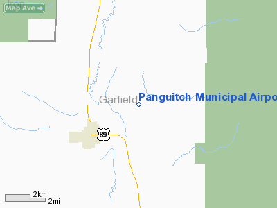
Location & QuickFacts
| FAA Information Effective: | 2008-09-25 |
| Airport Identifier: | U55 |
| Airport Status: | Operational |
| Longitude/Latitude: | 112-23-30.7430W/37-50-42.8400N
-112.391873/37.845233 (Estimated) |
| Elevation: | 6759 ft / 2060.14 m (Estimated) |
| Land: | 300 acres |
| From nearest city: | 3 nautical miles NE of Panguitch, UT |
| Location: | Garfield County, UT |
| Magnetic Variation: | 14E (1985) |
Owner & Manager
| Ownership: | Publicly owned |
| Owner: | Panguitch City Corp |
| Address: | 25 S. 200 E., Po Box 75
Panguitch, UT 84759 |
| Phone number: | 435-676-8585 |
| Manager: | Allen Henrie, City Manager |
| Address: | 25 South 200 East, Po Box 75
Panguitch, UT 84759 |
| Phone number: | 435-676-8585 |
Airport Operations and Facilities
| Airport Use: | Open to public |
| Wind indicator: | Yes |
| Segmented Circle: | Yes |
| Control Tower: | No |
| Lighting Schedule: | DUSK-DAWN
ACTVT MIRL RY 18/36 & PAPI RWYS 18 & 36 - CTAF. |
| Beacon Color: | Clear-Green (lighted land airport) |
| Landing fee charge: | No |
| Sectional chart: | Las Vegas |
| Region: | ANM - Northwest Mountain |
| Boundary ARTCC: | ZLC - Salt Lake City |
| Tie-in FSS: | CDC - Cedar City |
| FSS on Airport: | No |
| FSS Toll Free: | 1-800-WX-BRIEF |
| NOTAMs Facility: | CDC (NOTAM-d service avaliable) |
| Federal Agreements: | NSY1 |
Airport Communications
Airport Services
| Airframe Repair: | MINOR |
| Power Plant Repair: | MINOR |
| Bottled Oxygen: | NONE |
| Bulk Oxygen: | NONE |
Runway Information
Runway 18/36
| Dimension: | 5693 x 75 ft / 1735.2 x 22.9 m |
| Surface: | ASPH, Good Condition |
| Weight Limit: | Single wheel: 20000 lbs. |
| Edge Lights: | Medium |
| |
Runway 18 |
Runway 36 |
| Longitude: | 112-23-20.7430W | 112-23-40.7430W |
| Latitude: | 37-51-09.9200N | 37-50-15.9200N |
| Elevation: | 6759.00 ft | 6746.00 ft |
| Alignment: | 127 | 16 |
| Traffic Pattern: | Left | Left |
| Markings: | Non-precision instrument, Fair Condition | Basic, Good Condition |
| VASI: | 2-light PAPI on left side | 2-light PAPI on left side |
|
Radio Navigation Aids
| ID |
Type |
Name |
Ch |
Freq |
Var |
Dist |
| CDC | VOR/DME | Cedar City | 120X | 117.30 | 16E | 32.3 nm |
| BCE | VORTAC | Bryce Canyon | 075X | 112.80 | 15E | 10.3 nm |
| MLF | VORTAC | Milford | 058X | 112.10 | 16E | 42.7 nm |
Remarks
- PUBLIC PHONE AVAILABLE.
- ANTELOPE ON & INVOF ARPT DURG SUMMER MONTHS.
Images and information placed above are from
http://www.airport-data.com/airport/U55/
We thank them for the data!
| General Info
|
| Country |
United States
|
| State |
UTAH
|
| FAA ID |
U55
|
| Latitude |
37-50-42.840N
|
| Longitude |
112-23-30.743W
|
| Elevation |
6759 feet
|
| Near City |
PANGUITCH
|
We don't guarantee the information is fresh and accurate. The data may
be wrong or outdated.
For more up-to-date information please refer to other sources.
|
|


