 |
|
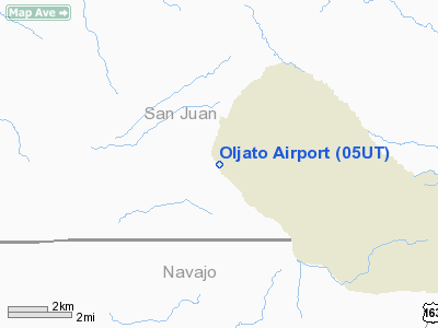
Location & QuickFacts
| FAA Information Effective: | 2008-09-25 |
| Airport Identifier: | 05UT |
| Airport Status: | Operational |
| Longitude/Latitude: | 110-19-02.4750W/37-01-59.9970N
-110.317354/37.033333 (Estimated) |
| Elevation: | 4838 ft / 1474.62 m (Estimated) |
| Land: | 15 acres |
| From nearest city: | 0 nautical miles E of Oljato, UT |
| Location: | San Juan County, UT |
| Magnetic Variation: | 13E (1985) |
Owner & Manager
| Ownership: | Privately owned |
| Owner: | Navajo Tribe
SAN JUAN CO, UT. |
| Address: | Box 1035
Windowrock, AZ 86515 |
| Manager: | Sarah T Holliday |
| Address: | Box 278
Kayenta, AZ 86033 |
| Phone number: | 801-727-3210 |
Airport Operations and Facilities
| Airport Use: | Private |
| Wind indicator: | Yes |
| Segmented Circle: | Yes |
| Control Tower: | No |
| Landing fee charge: | No |
| Sectional chart: | Denver |
| Region: | ANM - Northwest Mountain |
| Boundary ARTCC: | ZDV - Denver |
| Tie-in FSS: | CDC - Cedar City |
| FSS on Airport: | No |
| FSS Toll Free: | 1-800-WX-BRIEF |
Airport Communications
Airport Services
| Airframe Repair: | MINOR |
| Power Plant Repair: | NONE |
| Bottled Oxygen: | NONE |
| Bulk Oxygen: | NONE |
Runway Information
Runway 14/32
| Dimension: | 3950 x 50 ft / 1204.0 x 15.2 m |
| Surface: | ASPH, Poor Condition
RWY 14/32 HAS RUTS AND POTHOLES |
| Weight Limit: | Single wheel: 12500 lbs. |
| |
Runway 14 |
Runway 32 |
| Traffic Pattern: | Left | Left |
| Markings: | None, | None, |
| Runway End Identifier: | No | No |
| Centerline Lights: | No | No |
| Touchdown Lights: | No | No |
| Obstruction: | 4 ft road, 220.0 ft from runway, 1:1 slope to clear
+4' FENCE 100' FM THR. | , 50:1 slope to clear
+1' FENCE 90' FM THR. |
|
Radio Navigation Aids
| ID |
Type |
Name |
Ch |
Freq |
Var |
Dist |
| PBY | NDB | Peabody | | 259.00 | 13E | 33.9 nm |
Remarks
- CAUTION: RWY 14/32 TDZ AREAS DETERIORATING BADLY TO BARE EARTH.
- PRARIE DOG MOUNDS AND HOLES ON RY EDGE.
- EXISTED PRIOR TO 1959.
Images and information placed above are from
http://www.airport-data.com/airport/05UT/
We thank them for the data!
| General Info
|
| Country |
United States
|
| State |
UTAH
|
| FAA ID |
05UT
|
| Latitude |
37-01-59.997N
|
| Longitude |
110-19-02.475W
|
| Elevation |
4838 feet
|
| Near City |
OLJATO
|
We don't guarantee the information is fresh and accurate. The data may
be wrong or outdated.
For more up-to-date information please refer to other sources.
|
|


