 |
|
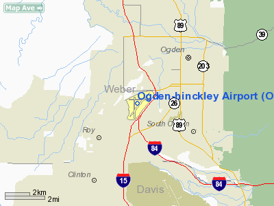
| Ogden-Hinckley Airport |
 |
| IATA: OGD – ICAO: KOGD |
| Summary |
| Airport type |
Public |
| Operator |
Ogden City Corp. |
| Location |
Ogden, Utah |
| Elevation AMSL |
4,473 ft / 1,363.4 m |
| Coordinates |
41°11′45.3″N 112°00′43.8″W / 41.195917°N 112.012167°W / 41.195917; -112.012167Coordinates: 41°11′45.3″N 112°00′43.8″W / 41.195917°N 112.012167°W / 41.195917; -112.012167 |
| Runways |
| Direction |
Length |
Surface |
| ft |
m |
| 3/21 |
8,103 |
2,470 |
Asphalt |
| 7/25 |
5,600 |
1,707 |
Asphalt |
| 16/34 |
5,195 |
1,583 |
Asphalt |
Ogden-Hinckley Airport (formerly Ogden Municipal Airport) (IATA: OGD, ICAO: KOGD) is a public airport located three miles (5 km) southwest of the city of Ogden in Weber County, Utah, U.S. It is billed as "Utah's Busiest Municipal Airport" and was a filming location for the 1997 film Con Air. History
During World War II the airfield was used by the United States Army Air Force. The airport serves general aviation aircraft consisting of private and business aircraft, charters, sight-seeing, air ambulance, and flight training. Although the airport is capable of handling larger passenger aircraft, the airport currently has no scheduled airline flights. The closest airport with scheduled airline flights is Salt Lake City International Airport, located approximately 30 miles south. In the event the Salt Lake City International Airport closes or has to turn away aircraft due circumstances such as weather conditions below landing minimums, Ogden-Hinckley is capable of accepting diverted commercial flights.
The airport is served by an FAA control tower with radar approach services provided by Salt Lake City TRACON.
Accidents and incidents
On 18 December 1953, a United States Air Force B-29 Superfortress scheduled to land at Hill Air Force Base landed at Ogden Municipal Airport by mistake. One of the eight crew was killed when the aircraft crashed and caught fire.
Culture and media
The airfield was a filming location for the 1997 film Con Air.
The above content comes from Wikipedia and is published under free licenses – click here to read more.
Location & QuickFacts
| FAA Information Effective: | 2008-09-25 |
| Airport Identifier: | OGD |
| Airport Status: | Operational |
| Longitude/Latitude: | 112-00-43.8000W/41-11-45.3000N
-112.012167/41.195917 (Estimated) |
| Elevation: | 4473 ft / 1363.37 m (Surveyed) |
| Land: | 720 acres |
| From nearest city: | 3 nautical miles SW of Ogden, UT |
| Location: | Weber County, UT |
| Magnetic Variation: | 14E (1985) |
Owner & Manager
| Ownership: | Publicly owned |
| Owner: | Ogden City Corporation |
| Address: | 2484 Washington Blvd
Ogden, UT 84401 |
| Phone number: | 801-629-8100 |
| Manager: | Ed Rich |
| Address: | 3909 Airport Rd.
Odgen, UT 84405 |
| Phone number: | 801-629-8251 |
Airport Operations and Facilities
| Airport Use: | Open to public |
| Wind indicator: | Yes |
| Segmented Circle: | Yes |
| Control Tower: | Yes |
| Lighting Schedule: | DUSK-DAWN
WHEN ATCT CLSD ACTVT HIRL RY 03/21 & MIRL RY 16/34 & TWY LGTS - CTAF. MIRL RY 07/25 & REIL RY 07 NOT AVBL WHEN ATCT CLSD. |
| Beacon Color: | Clear-Green (lighted land airport) |
| Landing fee charge: | No |
| Sectional chart: | Salt Lake City |
| Region: | ANM - Northwest Mountain |
| Boundary ARTCC: | ZLC - Salt Lake City |
| Tie-in FSS: | CDC - Cedar City |
| FSS on Airport: | No |
| FSS Toll Free: | 1-800-WX-BRIEF |
| NOTAMs Facility: | OGD (NOTAM-d service avaliable) |
| Certification type/date: | I B S 08/2007
CLSD TO ACFT OPNS WITH MORE THAN 30 PSGR SEATS EXCP PPR, MINIMUM 60 MINUTE NOTICE REQUIRED, CALL AMGR 801-629-8251/549-4081/625-5569. |
| Federal Agreements: | NGY3 |
Airport Communications
| CTAF: | 118.700 |
| Unicom: | 122.950 |
Airport Services
| Fuel available: | 100 A1+ |
| Airframe Repair: | MAJOR |
| Power Plant Repair: | MAJOR |
| Bottled Oxygen: | NONE |
| Bulk Oxygen: | HIGH/LOW |
Runway Information
Runway 03/21
| Dimension: | 8103 x 150 ft / 2469.8 x 45.7 m |
| Surface: | ASPH,
NUMEROUS LARGE AND DEEP CRACKS, BREAK-OUTS AND RAVELLING |
| Surface Treatment: | Saw-cut or plastic Grooved |
| Weight Limit: | Single wheel: 75000 lbs.
Dual wheel: 120000 lbs. |
| Edge Lights: | High |
| |
Runway 03 |
Runway 21 |
| Longitude: | 112-01-14.9569W | 112-00-00.2450W |
| Latitude: | 41-11-16.8903N | 41-12-13.6491N |
| Elevation: | 4472.00 ft | 4416.00 ft |
| Alignment: | 44 | 127 |
| ILS Type: | ILS/DME
| |
| Traffic Pattern: | Left | Right |
| Markings: | Precision instrument, Good Condition | Basic, Good Condition |
| Crossing Height: | 56.00 ft | 50.00 ft |
| Displaced threshold: | 0.00 ft | 851.00 ft |
| VASI: | 4-light PAPI on left side | 4-light PAPI on left side |
| Visual Glide Angle: | 3.00° | 3.00° |
| Approach lights: | MALS | |
| Obstruction: | 74 ft trees, 3500.0 ft from runway, 25 ft left of centerline, 44:1 slope to clear | 11 ft sign, 200.0 ft from runway, 150 ft right of centerline, 1:1 slope to clear
APCH SLOPE 34:1 TO DSPLCD THR.
+17' ROAD 350' FROM THR. |
| Decleard distances: | Take off run available 8103.00 ft
Take off distance available 8103.00 ft
Actual stop distance available 7252.00 ft
Landing distance available 7252.00 ft
| Take off run available 8103.00 ft
Take off distance available 8103.00 ft
Actual stop distance available 8103.00 ft
Landing distance available 7253.00 ft
|
|
Runway 07/25
| Dimension: | 5600 x 150 ft / 1706.9 x 45.7 m |
| Surface: | ASPH, Poor Condition
NUMEROUS LARGE AND DEEP CRACKS, BREAK-OUTS AND RAVELLING |
| Weight Limit: | Single wheel: 12500 lbs. |
| Edge Lights: | Medium |
| |
Runway 07 |
Runway 25 |
| Longitude: | 112-01-19.9919W | 112-00-06.7541W |
| Latitude: | 41-11-52.2997N | 41-11-52.5297N |
| Elevation: | 4448.00 ft | 4429.00 ft |
| Alignment: | 89 | 127 |
| Traffic Pattern: | Left | Right |
| Markings: | Non-precision instrument, Poor Condition
RYS 07 & 25 MASSIVE CRACK-SEALING HAS OBLITERATED MUCH OF THE MARKING | Basic, Poor Condition |
| Crossing Height: | 50.00 ft | 0.00 ft |
| Displaced threshold: | 0.00 ft | 160.00 ft |
| VASI: | 4-box on left side | |
| Visual Glide Angle: | 3.50° | 0.00° |
| Runway End Identifier: | No | |
| Obstruction: | 32 ft , 875.0 ft from runway, 325 ft right of centerline, 21:1 slope to clear | 13 ft road, 200.0 ft from runway, 250 ft left of centerline
APCH SLOPE 33:1 TO DSPLCD THR. |
| Decleard distances: | Take off run available 5600.00 ft
Take off distance available 5600.00 ft
Actual stop distance available 5600.00 ft
Landing distance available 5600.00 ft
| Take off run available 5600.00 ft
Take off distance available 5600.00 ft
Actual stop distance available 5600.00 ft
Landing distance available 5600.00 ft
|
|
Runway 16/34
| Dimension: | 5195 x 150 ft / 1583.4 x 45.7 m |
| Surface: | ASPH, Good Condition
NUMEROUS LARGE AND DEEP CRACKS, BREAK-OUTS AND RAVELLING |
| Surface Treatment: | Porous Friction Course |
| Weight Limit: | Single wheel: 50000 lbs.
Dual wheel: 75000 lbs. |
| Edge Lights: | Medium |
| |
Runway 16 |
Runway 34 |
| Longitude: | 112-00-53.8838W | 112-00-53.6561W |
| Latitude: | 41-12-03.1742N | 41-11-11.8539N |
| Elevation: | 4436.00 ft | 4457.00 ft |
| Alignment: | 127 | 127 |
| Traffic Pattern: | Right | Left |
| Markings: | Basic, Good Condition | Basic, Good Condition |
| Crossing Height: | 40.00 ft | 40.00 ft |
| VASI: | 2-light PAPI on left side | 2-light PAPI on left side |
| Visual Glide Angle: | 3.00° | 3.00° |
| Runway End Identifier: | Yes | Yes |
| Obstruction: | 3 ft road, 210.0 ft from runway, 125 ft right of centerline, 3:1 slope to clear | 50 ft sign, 1200.0 ft from runway, 200 ft right of centerline, 20:1 slope to clear |
| Decleard distances: | Take off run available 5194.00 ft
Take off distance available 5194.00 ft
Actual stop distance available 5194.00 ft
Landing distance available 5194.00 ft
| Take off run available 5195.00 ft
Take off distance available 5195.00 ft
Actual stop distance available 5195.00 ft
Landing distance available 5195.00 ft
|
|
Radio Navigation Aids
| ID |
Type |
Name |
Ch |
Freq |
Var |
Dist |
| BMC | NDB | Brigham City | | 294.00 | 16E | 19.5 nm |
| TVY | NDB | Tooele | | 371.00 | 13E | 38.3 nm |
| HIF | TACAN | Hill | 049X | | 14E | 5.0 nm |
| LHO | VOR/DME | Brigham City | 076X | 112.90 | 14E | 35.9 nm |
| LGU | VOR/DME | Logan | 035X | 109.80 | 16E | 39.5 nm |
| EVW | VOR/DME | Evanston | 33X | 109.60 | 13E | 43.9 nm |
| OGD | VORTAC | Ogden | 104X | 115.70 | 14E | 4.2 nm |
| TCH | VORTAC | Wasatch | 115X | 116.80 | 16E | 20.8 nm |
| SLC | VOT | Salt Lake City | | 111.00 | | 34.6 nm |
Remarks
- NO MULTIPLE APCHS. NO PRACTICE APCHS - FULL STOP LANDINGS ONLY FROM 2200-0700.
- PARACHUTE JUMPING ON AIRPORT BETWEEN RY 21 & 25.
- NO SNOW REMOVAL AFTER ATCT CLOSES.
- HVY VOL OF MILITARY ACFT FLYING OVER OGDEN AIRPORT AT 5700-6300 FT MSL ENROUTE TO HILL AFB.
Images and information placed above are from
http://www.airport-data.com/airport/OGD/
We thank them for the data!
| General Info
|
| Country |
United States
|
| State |
UTAH
|
| FAA ID |
OGD
|
| Latitude |
41-11-45.300N
|
| Longitude |
112-00-43.800W
|
| Elevation |
4473 feet
|
| Near City |
OGDEN
|
We don't guarantee the information is fresh and accurate. The data may
be wrong or outdated.
For more up-to-date information please refer to other sources.
|
|


