 |
|
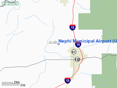
Location & QuickFacts
| FAA Information Effective: | 2008-09-25 |
| Airport Identifier: | U14 |
| Airport Status: | Operational |
| Longitude/Latitude: | 111-52-12.1900W/39-44-11.6500N
-111.870053/39.736569 (Estimated) |
| Elevation: | 5005 ft / 1525.52 m (Estimated) |
| Land: | 523 acres |
| From nearest city: | 3 nautical miles NW of Nephi, UT |
| Location: | Juab County, UT |
| Magnetic Variation: | 14E (1985) |
Owner & Manager
| Ownership: | Publicly owned |
| Owner: | City Of Nephi |
| Address: | 21 East 100 North
Nephi, UT 84648 |
| Phone number: | 435-623-0822 |
| Manager: | J. Randy Mcknight |
| Address: | 21 East 100 North
Nephi, UT 84648 |
| Phone number: | 435-623-0822 |
Airport Operations and Facilities
| Airport Use: | Open to public |
| Wind indicator: | Yes |
| Segmented Circle: | No |
| Control Tower: | No |
| Lighting Schedule: | DUSK-DAWN
ACTVT MIRL RWY 16/34, PAPI & REIL RWYS 16 & 34 - CTAF. |
| Beacon Color: | Clear-Green (lighted land airport) |
| Landing fee charge: | No |
| Sectional chart: | Las Vegas |
| Region: | ANM - Northwest Mountain |
| Boundary ARTCC: | ZLC - Salt Lake City |
| Tie-in FSS: | CDC - Cedar City |
| FSS on Airport: | No |
| FSS Toll Free: | 1-800-WX-BRIEF |
| NOTAMs Facility: | CDC (NOTAM-d service avaliable) |
| Federal Agreements: | N1 |
Airport Communications
| CTAF: | 122.800 |
| Unicom: | 122.800 |
Airport Services
| Fuel available: | 100LLA
FUEL AVAILABLE 24 HOURS, SELF SERVICE CREDIT CARD SYSTEM. |
| Airframe Repair: | NONE |
| Power Plant Repair: | NONE |
| Bottled Oxygen: | NONE |
| Bulk Oxygen: | NONE |
Runway Information
Runway 16/34
| Dimension: | 6298 x 100 ft / 1919.6 x 30.5 m |
| Surface: | ASPH, Good Condition |
| Weight Limit: | Dual wheel: 30000 lbs. |
| Edge Lights: | Medium |
| |
Runway 16 |
Runway 34 |
| Longitude: | 111-52-12.3000W | 111-52-12.0800W |
| Latitude: | 39-44-42.7700N | 39-43-40.5300N |
| Elevation: | 4986.00 ft | 5022.00 ft |
| Traffic Pattern: | Left | Left |
| Markings: | Non-precision instrument, Good Condition | Non-precision instrument, Good Condition |
| Crossing Height: | 40.00 ft | 40.00 ft |
| VASI: | 2-light PAPI on left side | 2-light PAPI on left side |
| Visual Glide Angle: | 3.00° | 3.00° |
| Runway End Identifier: | Yes | Yes |
|
Radio Navigation Aids
| ID |
Type |
Name |
Ch |
Freq |
Var |
Dist |
| PVU | VOR/DME | Provo | 021X | 108.40 | 15E | 29.6 nm |
| FFU | VORTAC | Fairfield | 113X | 116.60 | 16E | 32.5 nm |
| DTA | VORTAC | Delta | 108X | 116.10 | 16E | 39.4 nm |
Images and information placed above are from
http://www.airport-data.com/airport/U14/
We thank them for the data!
| General Info
|
| Country |
United States
|
| State |
UTAH
|
| FAA ID |
U14
|
| Latitude |
39-44-19.836N
|
| Longitude |
111-52-17.764W
|
| Elevation |
5009 feet
|
| Near City |
NEPHI
|
We don't guarantee the information is fresh and accurate. The data may
be wrong or outdated.
For more up-to-date information please refer to other sources.
|
|


