 |
|
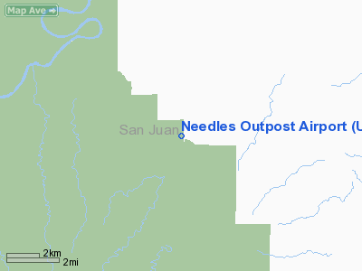
Location & QuickFacts
| FAA Information Effective: | 2008-09-25 |
| Airport Identifier: | UT59 |
| Airport Status: | Operational |
| Longitude/Latitude: | 109-44-38.4340W/38-10-32.9550N
-109.744009/38.175821 (Estimated) |
| Elevation: | 4950 ft / 1508.76 m (Estimated) |
| Land: | 7 acres |
| From nearest city: | 28 nautical miles NW of Monticello, UT |
| Location: | San Juan County, UT |
| Magnetic Variation: | 13E (1986) |
Owner & Manager
| Ownership: | Publicly owned |
| Owner: | State Of Utah |
| Address: |
|
| Manager: | Mark J. Davis |
| Address: | Po Box 1107
Monticello, UT 84535 |
| Phone number: | 801-259-2032
OR 801-259-8545. |
Airport Operations and Facilities
| Airport Use: | Private |
| Wind indicator: | Yes |
| Segmented Circle: | No |
| Control Tower: | No |
| Sectional chart: | Denver |
| Region: | ANM - Northwest Mountain |
| Boundary ARTCC: | ZDV - Denver |
| Tie-in FSS: | CDC - Cedar City |
| FSS on Airport: | No |
| FSS Toll Free: | 1-800-WX-BRIEF |
Runway Information
Runway 07/25
| Dimension: | 4500 x 60 ft / 1371.6 x 18.3 m |
| Surface: | DIRT, |
| |
Runway 07 |
Runway 25 |
| Traffic Pattern: | Left | Left |
|
Radio Navigation Aids
| ID |
Type |
Name |
Ch |
Freq |
Var |
Dist |
| OAB | VOR/DME | Moab | 035X | 109.80 | 15E | 34.9 nm |
| DVC | VORTAC | Dove Creek | 093X | 114.60 | 14E | 44.4 nm |
| HVE | VORTAC | Hanksville | 106X | 115.90 | 15E | 47.4 nm |
Images and information placed above are from
http://www.airport-data.com/airport/UT59/
We thank them for the data!
| General Info
|
| Country |
United States
|
| State |
UTAH
|
| FAA ID |
UT59
|
| Latitude |
38-10-32.955N
|
| Longitude |
109-44-38.434W
|
| Elevation |
4950 feet
|
| Near City |
MONTICELLO
|
We don't guarantee the information is fresh and accurate. The data may
be wrong or outdated.
For more up-to-date information please refer to other sources.
|
|


