 |
|
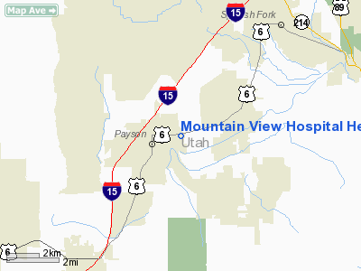
Mountain View Hospital Heliport |
Location & QuickFacts
| FAA Information Effective: | 2008-09-25 |
| Airport Identifier: | UT35 |
| Airport Status: | Operational |
| Longitude/Latitude: | 111-42-46.7400W/40-02-36.8360N
-111.712983/40.043566 (Estimated) |
| Elevation: | 4597 ft / 1401.17 m (Estimated) |
| Land: | 0 acres |
| From nearest city: | 2 nautical miles E of Payson, UT |
| Location: | Utah County, UT |
| Magnetic Variation: | 14E (1990) |
Owner & Manager
| Ownership: | Privately owned |
| Owner: | Mountain View Hospital, Inc. |
| Address: | 1000 East Hwy 6
Payson, UT 84651 |
| Phone number: | 801-465-7104 |
| Manager: | Richard Brunson |
| Address: | 1000 East Hwy 6
Payson, UT 84651 |
| Phone number: | 801-485-7104 |
Airport Operations and Facilities
| Airport Use: | Private
MEDICAL. |
| Wind indicator: | Yes |
| Segmented Circle: | No |
| Control Tower: | No |
| Lighting Schedule: | PHONE REQ
FOR PERIMETER LGTS CALL 801-465-7104. |
| Sectional chart: | Salt Lake City |
| Region: | ANM - Northwest Mountain |
| Boundary ARTCC: | ZLC - Salt Lake City |
| Tie-in FSS: | CDC - Cedar City |
| FSS on Airport: | No |
| FSS Toll Free: | 1-800-WX-BRIEF |
Runway Information
Helipad H1
| Dimension: | 60 x 60 ft / 18.3 x 18.3 m |
| Surface: | CONC, |
| |
Runway H1 |
Runway |
| Traffic Pattern: | Left | Left |
|
Radio Navigation Aids
| ID |
Type |
Name |
Ch |
Freq |
Var |
Dist |
| TVY | NDB | Tooele | | 371.00 | 13E | 44.8 nm |
| PVU | VOR/DME | Provo | 021X | 108.40 | 15E | 10.3 nm |
| FFU | VORTAC | Fairfield | 113X | 116.60 | 16E | 17.4 nm |
| SLC | VOT | Salt Lake City | | 111.00 | | 37.0 nm |
Remarks
- PRVDD APCH/DEP ROUTES ARE ONLY FM THR NORTH, WEST, AND SOUTHWEST.
Images and information placed above are from
http://www.airport-data.com/airport/UT35/
We thank them for the data!
| General Info
|
| Country |
United States
|
| State |
UTAH
|
| FAA ID |
UT35
|
| Latitude |
40-02-36.836N
|
| Longitude |
111-42-46.740W
|
| Elevation |
4597 feet
|
| Near City |
PAYSON
|
We don't guarantee the information is fresh and accurate. The data may
be wrong or outdated.
For more up-to-date information please refer to other sources.
|
|


