 |
|
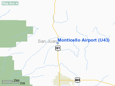
Location & QuickFacts
| FAA Information Effective: | 2008-09-25 |
| Airport Identifier: | U43 |
| Airport Status: | Operational |
| Longitude/Latitude: | 109-20-47.4190W/37-56-13.9740N
-109.346505/37.937215 (Estimated) |
| Elevation: | 6998 ft / 2132.99 m (Surveyed) |
| Land: | 75 acres |
| From nearest city: | 3 nautical miles N of Monticello, UT |
| Location: | San Juan County, UT |
| Magnetic Variation: | 13E (1985) |
Owner & Manager
| Ownership: | Publicly owned |
| Owner: | City Of Monticello |
| Address: | 17 N. 100 E., Po Box 457
Monticello, UT 84535 |
| Phone number: | 435-587-2271 |
| Manager: | Trent Schafer |
| Address: | Box 457
Monticello, UT 84535 |
| Phone number: | 435-587-2271 |
Airport Operations and Facilities
| Airport Use: | Open to public |
| Wind indicator: | Yes |
| Segmented Circle: | Yes |
| Control Tower: | No |
| Lighting Schedule: | DUSK-DAWN
ACTVT MIRL RY 16/34 & PAPI RYS 16 & 34 - CTAF. |
| Beacon Color: | Clear-Green (lighted land airport) |
| Landing fee charge: | No |
| Sectional chart: | Denver |
| Region: | ANM - Northwest Mountain |
| Boundary ARTCC: | ZDV - Denver |
| Tie-in FSS: | CDC - Cedar City |
| FSS on Airport: | No |
| FSS Toll Free: | 1-800-WX-BRIEF |
| NOTAMs Facility: | CDC (NOTAM-d service avaliable) |
| Federal Agreements: | NY1 |
Airport Communications
| CTAF: | 122.800 |
| Unicom: | 122.800 |
Airport Services
| Fuel available: | 100LLA
24 HR SELF SVC CREDIT CARD FUEL FAC. |
| Airframe Repair: | NONE |
| Power Plant Repair: | NONE |
| Bottled Oxygen: | NONE |
| Bulk Oxygen: | NONE |
Runway Information
Runway 16/34
| Dimension: | 4817 x 75 ft / 1468.2 x 22.9 m |
| Surface: | ASPH, Fair Condition |
| Weight Limit: | Single wheel: 11000 lbs. |
| Edge Lights: | Medium |
| |
Runway 16 |
Runway 34 |
| Traffic Pattern: | Left | Left |
| Markings: | Basic, Poor Condition
RY 16/34 MKGS FADED. | Basic, Poor Condition |
| Crossing Height: | 42.00 ft | 42.00 ft |
| VASI: | 2-light PAPI on left side | 2-light PAPI on left side |
| Visual Glide Angle: | 3.00° | 3.00° |
| Obstruction: | 24 ft tree, 747.0 ft from runway, 20 ft left of centerline, 22:1 slope to clear
+6 FT BRUSH 44 FT FM THR 104 FT R OF CNTRLN. | , 50:1 slope to clear |
|
Radio Navigation Aids
| ID |
Type |
Name |
Ch |
Freq |
Var |
Dist |
| HPL | NDB | Hopkins | | 375.00 | 13E | 41.2 nm |
| CEZ | VOR/DME | Cortez | 021X | 108.40 | 14E | 49.8 nm |
| DVC | VORTAC | Dove Creek | 093X | 114.60 | 14E | 21.2 nm |
Remarks
- NO LINE OF SIGHT BETWEEN RY ENDS.
- RY 16/34 HAS 5 FT TO 10 FT HILL ALONG WEST SIDE ENTIRE LENGTH 100 FT FM CNTRLN.
- 15 FT DROP OFF 165 FT FROM RY 34 END.
Images and information placed above are from
http://www.airport-data.com/airport/U43/
We thank them for the data!
| General Info
|
| Country |
United States
|
| State |
UTAH
|
| FAA ID |
U43
|
| Latitude |
37-56-13.974N
|
| Longitude |
109-20-47.419W
|
| Elevation |
6998 feet
|
| Near City |
MONTICELLO
|
We don't guarantee the information is fresh and accurate. The data may
be wrong or outdated.
For more up-to-date information please refer to other sources.
|
|


