 |
|
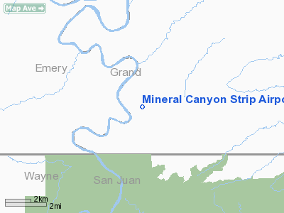
Mineral Canyon Strip Airport |
Location & QuickFacts
| FAA Information Effective: | 2008-09-25 |
| Airport Identifier: | UT75 |
| Airport Status: | Operational |
| Longitude/Latitude: | 109-59-00.0000W/38-32-00.0000N
-109.983333/38.533333 (Estimated) |
| Elevation: | 3900 ft / 1188.72 m (Estimated) |
| Land: | 0 acres |
| From nearest city: | 21 nautical miles SW of Moab, UT |
| Location: | Grand County, UT |
| Magnetic Variation: | 13E (1995) |
Owner & Manager
| Ownership: | Publicly owned |
| Owner: | Grand Resource Dist/blm |
| Address: | 885 S Sand Flats Road
Moab, UT 84523 |
| Phone number: | 801-259-8193 |
| Manager: | Grand Resource Dist/blm |
| Address: | 885 S Sand Flats Road
Moab, UT 84523 |
| Phone number: | 801-259-8193 |
Airport Operations and Facilities
| Airport Use: | Private |
| Wind indicator: | Yes |
| Segmented Circle: | No |
| Control Tower: | No |
| Sectional chart: | Denver |
| Region: | ANM - Northwest Mountain |
| Boundary ARTCC: | ZLC - Salt Lake City |
| Tie-in FSS: | CDC - Cedar City |
| FSS on Airport: | No |
| FSS Toll Free: | 1-800-WX-BRIEF |
Runway Information
Runway 14/32
| Dimension: | 2000 x 40 ft / 609.6 x 12.2 m |
| Surface: | DIRT, |
| |
Runway 14 |
Runway 32 |
| Traffic Pattern: | Right | Left |
| Obstruction: | 900 ft hill, 2000.0 ft from runway | 100 ft hill, 600.0 ft from runway |
|
Radio Navigation Aids
| ID |
Type |
Name |
Ch |
Freq |
Var |
Dist |
| OAB | VOR/DME | Moab | 035X | 109.80 | 15E | 17.3 nm |
| HVE | VORTAC | Hanksville | 106X | 115.90 | 15E | 34.4 nm |
Remarks
- ARPT USE FOR PERMIT HOLDER ONLY.
Images and information placed above are from
http://www.airport-data.com/airport/UT75/
We thank them for the data!
| General Info
|
| Country |
United States
|
| State |
UTAH
|
| FAA ID |
UT75
|
| Latitude |
38-32-00.000N
|
| Longitude |
109-59-00.000W
|
| Elevation |
3900 feet
|
| Near City |
MOAB
|
We don't guarantee the information is fresh and accurate. The data may
be wrong or outdated.
For more up-to-date information please refer to other sources.
|
|


