 |
|
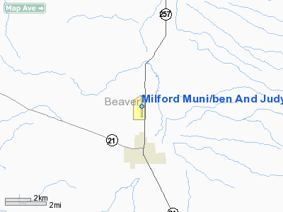
Milford Muni/ben And Judy Briscoe Field Airport |
Location & QuickFacts
| FAA Information Effective: | 2008-09-25 |
| Airport Identifier: | MLF |
| Airport Status: | Operational |
| Longitude/Latitude: | 113-00-44.8430W/38-25-35.8770N
-113.012456/38.426633 (Estimated) |
| Elevation: | 5039 ft / 1535.89 m (Estimated) |
| Land: | 556 acres |
| From nearest city: | 2 nautical miles N of Milford, UT |
| Location: | Beaver County, UT |
| Magnetic Variation: | 15E (1980) |
Owner & Manager
| Ownership: | Publicly owned |
| Owner: | City Of Milford |
| Address: | Po Box 69, 26 South 100 West
Milford, UT 84751 |
| Phone number: | 435-387-2711 |
| Manager: | Virginia Jones |
| Address: | Po Box 69
Milford, UT 84751 |
| Phone number: | 435-387-2637 |
Airport Operations and Facilities
| Airport Use: | Open to public |
| Wind indicator: | Yes |
| Segmented Circle: | No |
| Control Tower: | No |
| Lighting Schedule: | DUSK-DAWN
ACTIVATE MIRL RWY 16/34 & VASI RWYS 16 & 34 - 122.8. |
| Beacon Color: | Clear-Green (lighted land airport) |
| Landing fee charge: | No |
| Sectional chart: | Las Vegas |
| Region: | ANM - Northwest Mountain |
| Boundary ARTCC: | ZLC - Salt Lake City |
| Tie-in FSS: | CDC - Cedar City |
| FSS on Airport: | No |
| FSS Toll Free: | 1-800-WX-BRIEF |
| NOTAMs Facility: | MLF (NOTAM-d service avaliable) |
| Federal Agreements: | NGSY2 |
Airport Communications
| CTAF: | 122.800 |
| Unicom: | 122.800 |
Airport Services
| Fuel available: | 100LLA |
| Airframe Repair: | NONE |
| Power Plant Repair: | NONE |
| Bottled Oxygen: | NONE |
| Bulk Oxygen: | NONE |
Runway Information
Runway 16/34
| Dimension: | 5000 x 75 ft / 1524.0 x 22.9 m |
| Surface: | ASPH, Good Condition |
| Weight Limit: | Single wheel: 26000 lbs. |
| Edge Lights: | Medium |
| |
Runway 16 |
Runway 34 |
| Longitude: | 113-00-46.8400W | 113-00-46.8400W |
| Latitude: | 38-26-00.3100N | 38-25-10.8800N |
| Elevation: | 5023.00 ft | 5039.00 ft |
| Alignment: | 127 | 0 |
| Traffic Pattern: | Left | Left |
| Markings: | Non-precision instrument, Good Condition | Non-precision instrument, Good Condition |
| VASI: | 2-box on left side | 2-box on left side |
|
Radio Navigation Aids
| ID |
Type |
Name |
Ch |
Freq |
Var |
Dist |
| CDC | VOR/DME | Cedar City | 120X | 117.30 | 16E | 38.5 nm |
| MLF | VORTAC | Milford | 058X | 112.10 | 16E | 4.0 nm |
Remarks
- PILOTS ADVISE IF DOING TGL.
- EXISTED PRIOR TO 1959.
Images and information placed above are from
http://www.airport-data.com/airport/MLF/
We thank them for the data!
| General Info
|
| Country |
United States
|
| State |
UTAH
|
| FAA ID |
MLF
|
| Latitude |
38-25-35.877N
|
| Longitude |
113-00-44.843W
|
| Elevation |
5039 feet
|
| Near City |
MILFORD
|
We don't guarantee the information is fresh and accurate. The data may
be wrong or outdated.
For more up-to-date information please refer to other sources.
|
|


