 |
|
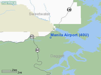
Location & QuickFacts
| FAA Information Effective: | 2008-09-25 |
| Airport Identifier: | 40U |
| Airport Status: | Operational |
| Longitude/Latitude: | 109-40-42.5320W/40-59-09.8520N
-109.678481/40.986070 (Estimated) |
| Elevation: | 6175 ft / 1882.14 m (Estimated) |
| Land: | 113 acres |
| From nearest city: | 2 nautical miles E of Manila, UT |
| Location: | Daggett County, UT |
| Magnetic Variation: | 14E (1985) |
Owner & Manager
| Ownership: | Publicly owned |
| Owner: | Daggett County |
| Address: | 95 N. 1st W., Po Box 219
Manila, UT 84046-0219 |
| Phone number: | 435-784-3154 |
| Manager: | Chad Reed
COUNTY COMMISSIONER. |
| Address: | 95 North 1st West, Po Box 219
Manila, UT 84046-0219 |
| Phone number: | 435-784-3210 |
Airport Operations and Facilities
| Airport Use: | Open to public |
| Wind indicator: | Yes |
| Segmented Circle: | Yes |
| Control Tower: | No |
| Lighting Schedule: | DUSK-DAWN
FOR RWY LGTS 07/25 KEY 122.8 5 TIMES. |
| Beacon Color: | Clear-Green (lighted land airport) |
| Landing fee charge: | No |
| Sectional chart: | Salt Lake City |
| Region: | ANM - Northwest Mountain |
| Boundary ARTCC: | ZLC - Salt Lake City |
| Tie-in FSS: | CDC - Cedar City |
| FSS on Airport: | No |
| FSS Toll Free: | 1-800-WX-BRIEF |
| NOTAMs Facility: | CDC (NOTAM-d service avaliable) |
| Federal Agreements: | NY1 |
Airport Communications
| CTAF: | 122.800 |
| Unicom: | 122.800 |
Airport Services
| Airframe Repair: | NONE |
| Power Plant Repair: | NONE |
| Bottled Oxygen: | NONE |
| Bulk Oxygen: | NONE |
Runway Information
Runway 07/25
| Dimension: | 5300 x 60 ft / 1615.4 x 18.3 m |
| Surface: | ASPH, Good Condition |
| Weight Limit: | Single wheel: 26000 lbs. |
| Edge Lights: | Medium |
| |
Runway 07 |
Runway 25 |
| Traffic Pattern: | Left | Left |
| Markings: | Basic, Fair Condition | Basic, Fair Condition |
| Obstruction: | 20 ft hill, 585.0 ft from runway, 19:1 slope to clear
+5' BUSHES 30' FM EOR. | , 50:1 slope to clear
RWY 25 +5 FT BUSHES 30 FT FM EOR. |
|
Radio Navigation Aids
| ID |
Type |
Name |
Ch |
Freq |
Var |
Dist |
| AOP | NDB | Antelope | | 290.00 | 13E | 48.1 nm |
| VEL | VOR/DME | Vernal | 019X | 108.20 | 15E | 37.5 nm |
| FBR | VOR/DME | Fort Bridger | 023X | 108.60 | 14E | 41.2 nm |
| OCS | VORTAC | Rock Springs | 107X | 116.00 | 13E | 47.1 nm |
Images and information placed above are from
http://www.airport-data.com/airport/40U/
We thank them for the data!
| General Info
|
| Country |
United States
|
| State |
UTAH
|
| FAA ID |
40U
|
| Latitude |
40-59-09.852N
|
| Longitude |
109-40-42.532W
|
| Elevation |
6175 feet
|
| Near City |
MANILA
|
We don't guarantee the information is fresh and accurate. The data may
be wrong or outdated.
For more up-to-date information please refer to other sources.
|
|


