 |
|
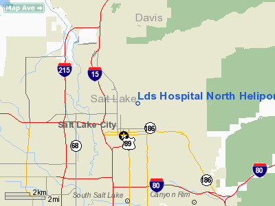
Lds Hospital North Heliport |
Location & QuickFacts
| FAA Information Effective: | 2008-09-25 |
| Airport Identifier: | UT55 |
| Airport Status: | Operational |
| Longitude/Latitude: | 111-52-47.7710W/40-46-44.8050N
-111.879936/40.779112 (Estimated) |
| Elevation: | 4729 ft / 1441.40 m (Surveyed) |
| Land: | 0 acres |
| From nearest city: | 0 nautical miles N of Salt Lake City, UT |
| Location: | Salt Lake County, UT |
| Magnetic Variation: | 15E (1985) |
Owner & Manager
| Ownership: | Privately owned |
| Owner: | Lds Hospital |
| Address: | 8th Avenue & C. Street
Salt Lake City, UT 84143 |
| Phone number: | 801-321-1234 |
| Manager: | Jerry Morrison
OTHER CONTACT: WILLIAM BUTTS 801-321-3355 BILL.BUTTS@IMAIL.ORG |
| Address: | 250 N. 2370 W
Salt Lake City, UT 84116 |
| Phone number: | 801-321-3332 |
Airport Operations and Facilities
| Airport Use: | Private
MEDICAL USE. |
| Wind indicator: | Yes |
| Segmented Circle: | No |
| Control Tower: | No |
| Sectional chart: | Salt Lake City |
| Region: | ANM - Northwest Mountain |
| Boundary ARTCC: | ZLC - Salt Lake City |
| Tie-in FSS: | CDC - Cedar City |
| FSS Toll Free: | 1-800-WX-BRIEF |
Airport Communications
Airport Services
Runway Information
Helipad H1
| Dimension: | 90 x 90 ft / 27.4 x 27.4 m |
| Surface: | CONC,
ROOFTOP. |
| |
Runway H1 |
Runway |
| Traffic Pattern: | Left | Left |
|
Radio Navigation Aids
| ID |
Type |
Name |
Ch |
Freq |
Var |
Dist |
| TVY | NDB | Tooele | | 371.00 | 13E | 23.6 nm |
| BMC | NDB | Brigham City | | 294.00 | 16E | 45.2 nm |
| HIF | TACAN | Hill | 049X | | 14E | 20.9 nm |
| PVU | VOR/DME | Provo | 021X | 108.40 | 15E | 34.7 nm |
| EVW | VOR/DME | Evanston | 33X | 109.60 | 13E | 48.0 nm |
| TCH | VORTAC | Wasatch | 115X | 116.80 | 16E | 6.3 nm |
| OGD | VORTAC | Ogden | 104X | 115.70 | 14E | 28.5 nm |
| FFU | VORTAC | Fairfield | 113X | 116.60 | 16E | 30.4 nm |
| SLC | VOT | Salt Lake City | | 111.00 | | 10.8 nm |
Images and information placed above are from
http://www.airport-data.com/airport/UT55/
We thank them for the data!
| General Info
|
| Country |
United States
|
| State |
UTAH
|
| FAA ID |
UT55
|
| Latitude |
40-46-44.805N
|
| Longitude |
111-52-47.771W
|
| Elevation |
4729 feet
|
| Near City |
SALT LAKE CITY
|
We don't guarantee the information is fresh and accurate. The data may
be wrong or outdated.
For more up-to-date information please refer to other sources.
|
|


