 |
|
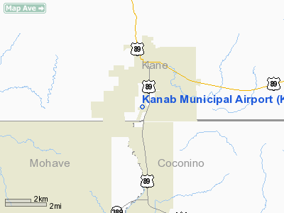
Location & QuickFacts
| FAA Information Effective: | 2008-09-25 |
| Airport Identifier: | KNB |
| Airport Status: | Operational |
| Longitude/Latitude: | 112-31-52.2970W/37-00-39.9810N
-112.531194/37.011106 (Estimated) |
| Elevation: | 4868 ft / 1483.77 m (Estimated) |
| Land: | 167 acres |
| From nearest city: | 2 nautical miles S of Kanab, UT |
| Location: | Kane County, UT |
| Magnetic Variation: | 15E (1980) |
Owner & Manager
| Ownership: | Publicly owned |
| Owner: | City Of Kanab |
| Address: | 76 North Main
Kanab, UT 84741 |
| Phone number: | 435-644-2534 |
| Manager: | Dick Brewer |
| Address: | 2378 South Highway 89a
Kanab, UT 84741 |
| Phone number: | (435) 644-2299 |
Airport Operations and Facilities
| Airport Use: | Open to public |
| Wind indicator: | Yes |
| Segmented Circle: | Yes |
| Control Tower: | No |
| Lighting Schedule: | DUSK-DAWN
ACTVT MIRL RY 01/19 & PAPI RY 01 - CTAF. |
| Beacon Color: | Clear-Green (lighted land airport) |
| Landing fee charge: | No |
| Sectional chart: | Las Vegas |
| Region: | ANM - Northwest Mountain |
| Boundary ARTCC: | ZLA - Los Angeles |
| Tie-in FSS: | CDC - Cedar City |
| FSS on Airport: | No |
| FSS Toll Free: | 1-800-WX-BRIEF |
| NOTAMs Facility: | CDC (NOTAM-d service avaliable) |
| Federal Agreements: | NGY |
Airport Communications
| CTAF: | 122.800 |
| Unicom: | 122.800 |
Airport Services
| Fuel available: | 100LLA |
| Airframe Repair: | MAJOR |
| Power Plant Repair: | MAJOR |
| Bottled Oxygen: | NONE |
| Bulk Oxygen: | NONE |
Runway Information
Runway 01/19
| Dimension: | 6193 x 75 ft / 1887.6 x 22.9 m |
| Surface: | ASPH, Good Condition |
| Weight Limit: | Single wheel: 12500 lbs. |
| Edge Lights: | Medium |
| |
Runway 01 |
Runway 19 |
| Longitude: | 112-32-06.9200W | 112-31-39.6600W |
| Latitude: | 37-00-09.3100N | 37-01-06.4600N |
| Elevation: | 4823.00 ft | 4868.00 ft |
| Alignment: | 21 | 127 |
| Traffic Pattern: | Left | Left |
| Markings: | Non-precision instrument, Good Condition | Basic, Good Condition |
| Crossing Height: | 40.00 ft | 0.00 ft |
| VASI: | 2-light PAPI on left side | |
| Visual Glide Angle: | 3.00° | 0.00° |
| Obstruction: | 33 ft tree, 1470.0 ft from runway, 250 ft right of centerline, 38:1 slope to clear | 22 ft bldg, 880.0 ft from runway, 235 ft left of centerline, 30:1 slope to clear |
|
Radio Navigation Aids
| ID |
Type |
Name |
Ch |
Freq |
Var |
Dist |
| AZC | NDB | Colorado City | | 403.00 | 13E | 23.2 nm |
| BCE | VORTAC | Bryce Canyon | 075X | 112.80 | 15E | 42.2 nm |
Images and information placed above are from
http://www.airport-data.com/airport/KNB/
We thank them for the data!
| General Info
|
| Country |
United States
|
| State |
UTAH
|
| FAA ID |
KNB
|
| Latitude |
37-00-39.981N
|
| Longitude |
112-31-52.297W
|
| Elevation |
4867 feet
|
| Near City |
KANAB
|
We don't guarantee the information is fresh and accurate. The data may
be wrong or outdated.
For more up-to-date information please refer to other sources.
|
|


