 |
|
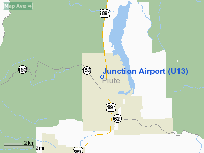
Location & QuickFacts
| FAA Information Effective: | 2008-09-25 |
| Airport Identifier: | U13 |
| Airport Status: | Operational |
| Longitude/Latitude: | 112-13-31.7300W/38-14-59.9220N
-112.225481/38.249978 (Estimated) |
| Elevation: | 6069 ft / 1849.83 m (Estimated) |
| Land: | 144 acres |
| From nearest city: | 1 nautical miles N of Junction, UT |
| Location: | Piute County, UT |
| Magnetic Variation: | 14E (1985) |
Owner & Manager
| Ownership: | Publicly owned |
| Owner: | Town Of Junction |
| Address: | 550 N. Main, Po Box 26
Junction, UT 84740 |
| Phone number: | 435-577-2840 |
| Manager: | Rickey Dalton |
| Address: | Box 26, Po Box 26
Junction, UT 84740 |
| Phone number: | 435-577-2840 |
Airport Operations and Facilities
| Airport Use: | Open to public |
| Wind indicator: | Yes |
| Segmented Circle: | Yes |
| Control Tower: | No |
| Landing fee charge: | No |
| Sectional chart: | Las Vegas |
| Region: | ANM - Northwest Mountain |
| Boundary ARTCC: | ZLC - Salt Lake City |
| Tie-in FSS: | CDC - Cedar City |
| FSS on Airport: | No |
| FSS Toll Free: | 1-800-WX-BRIEF |
| NOTAMs Facility: | CDC (NOTAM-d service avaliable) |
| Federal Agreements: | 1 |
Airport Communications
Airport Services
| Airframe Repair: | NONE |
| Power Plant Repair: | NONE |
| Bottled Oxygen: | NONE |
| Bulk Oxygen: | NONE |
Runway Information
Runway 17/35
| Dimension: | 4505 x 60 ft / 1373.1 x 18.3 m |
| Surface: | ASPH, Good Condition |
| |
Runway 17 |
Runway 35 |
| Traffic Pattern: | Left | Left |
| Markings: | Basic, Good Condition | Basic, Good Condition |
| Obstruction: | 7 ft hill, 339.0 ft from runway, 40 ft left of centerline, 19:1 slope to clear
RWY 17 +4 FT FENCE; 190 FT FROM RY END. | 71 ft tree, 584.0 ft from runway, 108 ft right of centerline, 5:1 slope to clear
RWY 35 +4' FENCE, 190' FROM RY END. |
|
Radio Navigation Aids
| ID |
Type |
Name |
Ch |
Freq |
Var |
Dist |
| CDC | VOR/DME | Cedar City | 120X | 117.30 | 16E | 48.6 nm |
| BCE | VORTAC | Bryce Canyon | 075X | 112.80 | 15E | 33.9 nm |
| MLF | VORTAC | Milford | 058X | 112.10 | 16E | 37.7 nm |
Remarks
Images and information placed above are from
http://www.airport-data.com/airport/U13/
We thank them for the data!
| General Info
|
| Country |
United States
|
| State |
UTAH
|
| FAA ID |
U13
|
| Latitude |
38-14-59.922N
|
| Longitude |
112-13-31.730W
|
| Elevation |
6069 feet
|
| Near City |
JUNCTION
|
We don't guarantee the information is fresh and accurate. The data may
be wrong or outdated.
For more up-to-date information please refer to other sources.
|
|


