 |
|
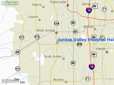
Jordan Valley Hospital Heliport |
Location & QuickFacts
| FAA Information Effective: | 2008-09-25 |
| Airport Identifier: | UT87 |
| Airport Status: | Operational |
| Longitude/Latitude: | 111-58-33.0000W/40-35-26.0000N
-111.975833/40.590556 (Estimated) |
| Elevation: | 4590 ft / 1399.03 m (Estimated) |
| Land: | 28 acres |
| From nearest city: | 0 nautical miles W of West Jordan, UT |
| Location: | Salt Lake County, UT |
| Magnetic Variation: | () |
Owner & Manager
| Ownership: | Privately owned |
| Owner: | Jordan Valley Hospital L.p. |
| Address: | 3580 West 9000 South
West Jordan, UT 84088 |
| Phone number: | 801-561-8888 |
| Manager: | Robert Canestrini |
| Address: | 3580 West 9000 South
West Jordan, UT 84088 |
| Phone number: | 801-562-4213 |
Airport Operations and Facilities
| Airport Use: | Private
MEDICAL USE. |
| Wind indicator: | Yes |
| Control Tower: | No |
| Sectional chart: | Salt Lake City |
| Region: | ANM - Northwest Mountain |
| Boundary ARTCC: | ZLC - Salt Lake City |
| Tie-in FSS: | CDC - Cedar City |
| FSS Toll Free: | 1-800-WX-BRIEF |
Runway Information
Helipad H1
| Dimension: | 60 x 60 ft / 18.3 x 18.3 m |
| Surface: | CONC, |
| |
Runway H1 |
Runway |
| Traffic Pattern: | Left | Left |
|
Radio Navigation Aids
| ID |
Type |
Name |
Ch |
Freq |
Var |
Dist |
| TVY | NDB | Tooele | | 371.00 | 13E | 17.0 nm |
| HIF | TACAN | Hill | 049X | | 14E | 31.9 nm |
| MIJ | TACAN | Michael | 079X | | 15E | 49.5 nm |
| PVU | VOR/DME | Provo | 021X | 108.40 | 15E | 25.4 nm |
| TCH | VORTAC | Wasatch | 115X | 116.80 | 16E | 15.6 nm |
| FFU | VORTAC | Fairfield | 113X | 116.60 | 16E | 19.0 nm |
| OGD | VORTAC | Ogden | 104X | 115.70 | 14E | 38.5 nm |
| SLC | VOT | Salt Lake City | | 111.00 | | 2.0 nm |
Images and information placed above are from
http://www.airport-data.com/airport/UT87/
We thank them for the data!
|
|


