 |
|
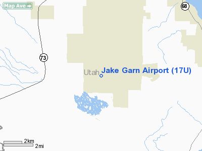
Location & QuickFacts
| FAA Information Effective: | 2008-09-25 |
| Airport Identifier: | 17U |
| Airport Status: | Operational |
| Longitude/Latitude: | 112-01-15.5100W/40-15-49.4800N
-112.020975/40.263744 (Estimated) |
| Elevation: | 4845 ft / 1476.76 m (Estimated) |
| Land: | 438 acres |
| From nearest city: | 35 nautical miles SW of Eagle Mountain, UT |
| Location: | Utah County, UT |
| Magnetic Variation: | 14E (1995) |
Owner & Manager
| Ownership: | Privately owned |
| Owner: | Eagle Mountain Properties, Llc |
| Address: | 1757 East American Way, #6
Eagle Mountain, UT 84043 |
| Phone number: | 801-358-6264 |
| Manager: | Eric Jones |
| Address: | 1757 East American Way, #6
Eagle Mountain, UT 84043 |
| Phone number: | 801-358-6264 |
Airport Operations and Facilities
| Airport Use: | Open to public |
| Wind indicator: | Yes |
| Segmented Circle: | No |
| Control Tower: | No |
| Sectional chart: | Salt Lake City |
| Region: | ANM - Northwest Mountain |
| Boundary ARTCC: | ZLC - Salt Lake City |
| Tie-in FSS: | CDC - Cedar City |
| FSS Toll Free: | 1-800-WX-BRIEF |
| NOTAMs Facility: | CDC (NOTAM-d service avaliable) |
Airport Communications
| CTAF: | 123.000 |
| Unicom: | 123.000 |
Runway Information
Runway 17/35
| Dimension: | 5000 x 50 ft / 1524.0 x 15.2 m |
| Surface: | ASPH-GRVL, Poor Condition
RY 17/35 ASPH PORTION FAIR WITH WEEDS GROWING THRU CRACKS; GRVL PORTION UNUSBL.
NORTH 2500 FT OF RY 17/35 ASPH; REMAINDER GRVL. |
| |
Runway 17 |
Runway 35 |
| Traffic Pattern: | Right | Left |
| Markings: | Nonstandard, Fair Condition
RY 17 MKGS NSTD; END FRFLECTORS 34 FT FM THLD, DOUBLE 17 MKGS. | Nonstandard, Fair Condition
RY 35 NO IDENTIFIER, NO CNTRLN MKGS. |
|
Radio Navigation Aids
| ID |
Type |
Name |
Ch |
Freq |
Var |
Dist |
| TVY | NDB | Tooele | | 371.00 | 13E | 25.7 nm |
| DPG | NDB | Dugway | | 284.00 | 15E | 42.3 nm |
| MIJ | TACAN | Michael | 079X | | 15E | 41.6 nm |
| PVU | VOR/DME | Provo | 021X | 108.40 | 15E | 14.1 nm |
| FFU | VORTAC | Fairfield | 113X | 116.60 | 16E | 3.7 nm |
| TCH | VORTAC | Wasatch | 115X | 116.80 | 16E | 35.3 nm |
| SLC | VOT | Salt Lake City | | 111.00 | | 21.5 nm |
Remarks
- WEEDS GROWING THRU CRACKS IN TWY.
Images and information placed above are from
http://www.airport-data.com/airport/17U/
We thank them for the data!
| General Info
|
| Country |
United States
|
| State |
UTAH
|
| FAA ID |
17U
|
| Latitude |
40-15-49.480N
|
| Longitude |
112-01-15.510W
|
| Elevation |
4845 feet
|
| Near City |
EAGLE MOUNTAIN
|
We don't guarantee the information is fresh and accurate. The data may
be wrong or outdated.
For more up-to-date information please refer to other sources.
|
|


