 |
|
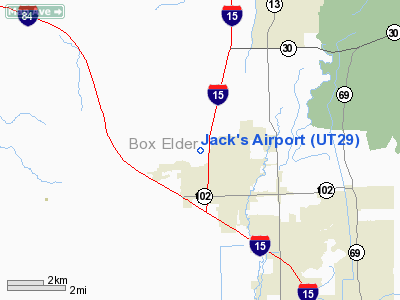
Location & QuickFacts
| FAA Information Effective: | 2008-09-25 |
| Airport Identifier: | UT29 |
| Airport Status: | Operational |
| Longitude/Latitude: | 112-11-39.0000W/41-44-02.0000N
-112.194167/41.733889 (Estimated) |
| Elevation: | 4440 ft / 1353.31 m (Estimated) |
| Land: | 175 acres |
| From nearest city: | 1 nautical miles NE of Tremonton, UT |
| Location: | Box Elder County, UT |
| Magnetic Variation: | 14E (1995) |
Owner & Manager
| Ownership: | Privately owned |
| Owner: | Laurence J. Pierce Revocable Trust |
| Address: | 967 Fishburn Drive
Brigham City, UT 84302 |
| Phone number: | 435-723-8372 |
| Manager: | Larry J. Pierce |
| Address: | 967 Fishburn Dr
Brigham City, UT 84302 |
| Phone number: | 435-723-8372 |
Airport Operations and Facilities
| Airport Use: | Private |
| Wind indicator: | Yes |
| Segmented Circle: | No |
| Control Tower: | No |
| Sectional chart: | Salt Lake City |
| Region: | ANM - Northwest Mountain |
| Boundary ARTCC: | ZLC - Salt Lake City |
| Tie-in FSS: | CDC - Cedar City |
| FSS Toll Free: | 1-800-WX-BRIEF |
Runway Information
Runway 04/22
| Dimension: | 3650 x 120 ft / 1112.5 x 36.6 m |
| Surface: | TURF-DIRT, Fair Condition |
| |
Runway 04 |
Runway 22 |
| Traffic Pattern: | Left | Left |
|
Radio Navigation Aids
| ID |
Type |
Name |
Ch |
Freq |
Var |
Dist |
| BMC | NDB | Brigham City | | 294.00 | 16E | 14.1 nm |
| HIF | TACAN | Hill | 049X | | 14E | 38.3 nm |
| LHO | VOR/DME | Brigham City | 076X | 112.90 | 14E | 9.0 nm |
| LGU | VOR/DME | Logan | 035X | 109.80 | 16E | 16.2 nm |
| MLD | VOR/DME | Malad City | 121X | 117.40 | 17E | 30.3 nm |
| OGD | VORTAC | Ogden | 104X | 115.70 | 14E | 30.9 nm |
Images and information placed above are from
http://www.airport-data.com/airport/UT29/
We thank them for the data!
| General Info
|
| Country |
United States
|
| State |
UTAH
|
| FAA ID |
UT29
|
| Latitude |
41-44-02.000N
|
| Longitude |
112-11-39.000W
|
| Elevation |
4440 feet
|
| Near City |
TREMONTON
|
We don't guarantee the information is fresh and accurate. The data may
be wrong or outdated.
For more up-to-date information please refer to other sources.
|
|


