 |
|
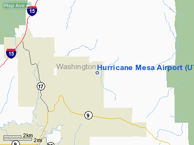
Location & QuickFacts
| FAA Information Effective: | 2008-09-25 |
| Airport Identifier: | UT27 |
| Airport Status: | Operational |
| Longitude/Latitude: | 113-12-30.8080W/37-15-03.9360N
-113.208558/37.251093 (Estimated) |
| Elevation: | 5105 ft / 1556.00 m (Surveyed) |
| Land: | 0 acres |
| From nearest city: | 6 nautical miles NE of Hurricane, UT |
| Location: | Washington County, UT |
| Magnetic Variation: | 14E (1985) |
Owner & Manager
| Ownership: | Privately owned |
| Owner: | Universal Propulsion Co Inc |
| Address: | 25401 North Central Ave
Phoenix, AZ 85027 |
| Phone number: | 602-869-8067 |
| Manager: | Ronald Chase |
| Address: | Box 1218
Hurricane, UT 84737 |
| Phone number: | 801-635-9629 |
Airport Operations and Facilities
| Airport Use: | Private |
| Wind indicator: | Yes |
| Segmented Circle: | No |
| Control Tower: | No |
| Landing fee charge: | No |
| Sectional chart: | Las Vegas |
| Region: | ANM - Northwest Mountain |
| Boundary ARTCC: | ZLA - Los Angeles |
| Tie-in FSS: | CDC - Cedar City |
| FSS on Airport: | No |
| FSS Toll Free: | 1-800-WX-BRIEF |
Airport Communications
Airport Services
| Airframe Repair: | NONE |
| Power Plant Repair: | NONE |
Runway Information
Runway 15/33
| Dimension: | 5000 x 80 ft / 1524.0 x 24.4 m |
| Surface: | GRVL-TRTD, |
| |
Runway 15 |
Runway 33 |
| Traffic Pattern: | Right | Left |
|
Radio Navigation Aids
| ID |
Type |
Name |
Ch |
Freq |
Var |
Dist |
| AZC | NDB | Colorado City | | 403.00 | 13E | 19.9 nm |
| OZN | VOR/DME | St George | 035X | 109.80 | 15E | 20.8 nm |
| CDC | VOR/DME | Cedar City | 120X | 117.30 | 16E | 32.9 nm |
Remarks
- ARPT HAZARDOUS DUE TO WINDS.
- FILED FOR RECORD PURPOSES ONLY, PVT APT; LCTD MORE THAN 20 NM FM AN IFR APT AND MORE THAN 5 NM FM AN APT OPEN TO THE PUBLIC.
Images and information placed above are from
http://www.airport-data.com/airport/UT27/
We thank them for the data!
| General Info
|
| Country |
United States
|
| State |
UTAH
|
| FAA ID |
UT27
|
| Latitude |
37-15-03.936N
|
| Longitude |
113-12-30.808W
|
| Elevation |
5105 feet
|
| Near City |
HURRICANE
|
We don't guarantee the information is fresh and accurate. The data may
be wrong or outdated.
For more up-to-date information please refer to other sources.
|
|


