 |
|
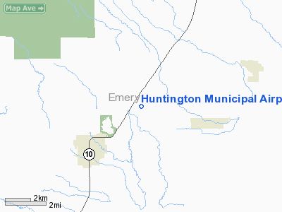
Location & QuickFacts
| FAA Information Effective: | 2008-09-25 |
| Airport Identifier: | 69V |
| Airport Status: | Operational |
| Longitude/Latitude: | 110-55-01.1300W/39-21-40.4090N
-110.916981/39.361225 (Estimated) |
| Elevation: | 5915 ft / 1802.89 m (Estimated) |
| Land: | 333 acres |
| From nearest city: | 3 nautical miles NE of Huntington, UT |
| Location: | Emery County, UT |
| Magnetic Variation: | 14E (1985) |
Owner & Manager
| Ownership: | Publicly owned |
| Owner: | Emery County |
| Address: | 95 East Main
Castle Dale, UT 84513 |
| Phone number: | 435-381-2119 |
| Manager: | Ira Hatch |
| Address: | Po Box 629, 95 East Main
Castle Dale, UT 84513 |
| Phone number: | 435-381-2119 |
Airport Operations and Facilities
| Airport Use: | Open to public |
| Wind indicator: | Yes |
| Segmented Circle: | No |
| Control Tower: | No |
| Lighting Schedule: | DUSK-DAWN
ACTVT MIRL RY 08/26 - CTAF. |
| Beacon Color: | Clear-Green (lighted land airport) |
| Landing fee charge: | No |
| Sectional chart: | Denver |
| Region: | ANM - Northwest Mountain |
| Boundary ARTCC: | ZLC - Salt Lake City |
| Tie-in FSS: | CDC - Cedar City |
| FSS on Airport: | No |
| FSS Toll Free: | 1-800-WX-BRIEF |
| NOTAMs Facility: | CDC (NOTAM-d service avaliable) |
Airport Communications
| CTAF: | 122.800 |
| Unicom: | 122.800 |
Airport Services
| Fuel available: | 100LL
24 HR CREDIT CARD SVC AVBL. |
| Bottled Oxygen: | NONE |
| Bulk Oxygen: | NONE |
Runway Information
Runway 08/26
| Dimension: | 4048 x 75 ft / 1233.8 x 22.9 m |
| Surface: | ASPH, Fair Condition
SMALL AMOUNTS OF VEGETATION ON RUNWAY 12/30.
SMALL AMOUNTS OF VEGETATION ON RUNWAY 18/36. |
| Weight Limit: | Single wheel: 12500 lbs. |
| Edge Lights: | Medium |
| |
Runway 08 |
Runway 26 |
| Longitude: | 110-55-25.5900W | 110-54-34.0400W |
| Latitude: | 39-21-39.7900N | 39-21-39.8600N |
| Elevation: | 5903.00 ft | 5872.00 ft |
| Alignment: | 90 | 127 |
| Traffic Pattern: | Left | Left |
| Markings: | Basic, Good Condition | Basic, Good Condition |
| Obstruction: | , 50:1 slope to clear
RY 08 +9' FENCE AT RWY END. | 12 ft road, 250.0 ft from runway, 115 ft right of centerline, 4:1 slope to clear
RY 26 +6' FENCE POST 55' FRM THR. |
|
Runway 12/30
| Dimension: | 3640 x 70 ft / 1109.5 x 21.3 m |
| Surface: | DIRT, Fair Condition
SMALL AMOUNTS OF VEGETATION ON RUNWAY 12/30.
SMALL AMOUNTS OF VEGETATION ON RUNWAY 18/36. |
| Weight Limit: | Single wheel: 6000 lbs. |
| |
Runway 12 |
Runway 30 |
| Longitude: | 110-55-14.6000W | 110-54-44.5900W |
| Latitude: | 39-21-54.4300N | 39-21-26.9800N |
| Elevation: | 5915.00 ft | 5873.00 ft |
| Alignment: | 127 | 127 |
| Traffic Pattern: | Left | Left |
| Obstruction: | 13 ft fence, 110.0 ft from runway, 8:1 slope to clear | 44 ft tree, 175.0 ft from runway, 170 ft left of centerline, 3:1 slope to clear
+15' TREE 28' LEFT OF CNTRLN EXTNDD. |
|
Runway 18/36
| Dimension: | 2079 x 56 ft / 633.7 x 17.1 m |
| Surface: | DIRT, Fair Condition
SMALL AMOUNTS OF VEGETATION ON RUNWAY 12/30.
SMALL AMOUNTS OF VEGETATION ON RUNWAY 18/36. |
| |
Runway 18 |
Runway 36 |
| Longitude: | 110-55-01.2800W | 110-55-11.4800W |
| Latitude: | 39-21-50.5100N | 39-21-31.5500N |
| Elevation: | 5902.00 ft | 5888.00 ft |
| Alignment: | 127 | 23 |
| Traffic Pattern: | Left | Left |
|
Radio Navigation Aids
| ID |
Type |
Name |
Ch |
Freq |
Var |
Dist |
| PUC | VOR/DME | Carbon | 102X | 115.50 | 14E | 16.4 nm |
Remarks
- RY 08/26 NO LINE OF SIGHT BTN RY ENDS.
- EXISTED PRIOR TO 1959.
Images and information placed above are from
http://www.airport-data.com/airport/69V/
We thank them for the data!
| General Info
|
| Country |
United States
|
| State |
UTAH
|
| FAA ID |
69V
|
| Latitude |
39-21-40.887N
|
| Longitude |
110-55-00.593W
|
| Elevation |
5909 feet
|
| Near City |
HUNTINGTON
|
We don't guarantee the information is fresh and accurate. The data may
be wrong or outdated.
For more up-to-date information please refer to other sources.
|
|


