 |
|
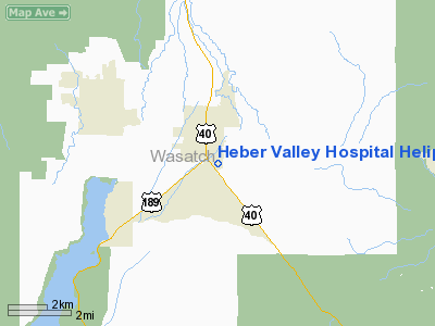
Heber Valley Hospital Heliport |
Location & QuickFacts
| FAA Information Effective: | 2008-09-25 |
| Airport Identifier: | 2UT4 |
| Airport Status: | Operational |
| Longitude/Latitude: | 111-24-20.6500W/40-29-24.8300N
-111.405736/40.490231 (Estimated) |
| Elevation: | 5681 ft / 1731.57 m (Estimated) |
| Land: | 40 acres |
| From nearest city: | 1 nautical miles SW of Heber City, UT |
| Location: | Wasatch County, UT |
| Magnetic Variation: | 13E (2000) |
Owner & Manager
| Ownership: | Privately owned |
| Owner: | Ihc Health Services Inc |
| Address: | 36 So. State Street
Salt Lake City, UT 84111 |
| Phone number: | 801-442-3449 |
| Manager: | Robert Giles |
| Address: | 1485 South Highway 40
Heber City, UT 84032 |
| Phone number: | 435-654-2500 |
Airport Operations and Facilities
| Airport Use: | Private |
| Wind indicator: | Yes |
| Segmented Circle: | No |
| Control Tower: | No |
| Sectional chart: | Salt Lake City |
| Region: | ANM - Northwest Mountain |
| Boundary ARTCC: | ZLC - Salt Lake City |
| Tie-in FSS: | CDC - Cedar City |
| FSS Toll Free: | 1-800-WX-BRIEF |
Runway Information
Helipad H1
| Dimension: | 40 x 40 ft / 12.2 x 12.2 m |
| Surface: | CONC, Good Condition |
| |
Runway H1 |
Runway |
| Traffic Pattern: | Left | Left |
|
Radio Navigation Aids
| ID |
Type |
Name |
Ch |
Freq |
Var |
Dist |
| TVY | NDB | Tooele | | 371.00 | 13E | 43.6 nm |
| HIF | TACAN | Hill | 049X | | 14E | 45.6 nm |
| PVU | VOR/DME | Provo | 021X | 108.40 | 15E | 22.0 nm |
| EVW | VOR/DME | Evanston | 33X | 109.60 | 13E | 49.8 nm |
| FFU | VORTAC | Fairfield | 113X | 116.60 | 16E | 27.7 nm |
| TCH | VORTAC | Wasatch | 115X | 116.80 | 16E | 34.0 nm |
| SLC | VOT | Salt Lake City | | 111.00 | | 27.9 nm |
Remarks
- PRVDD THE THREE 10 FT TALL HELIPAD LGTS LOCATED ON THE N, E, AND S SIDES OF HELIPAD REMOVED AND THE 15 LIGHTS THAT ARE 18 INCHES TALL ON THE HELIPAD BE REMOVED OR RELOCATED TO OUTER EDGE OF HELIPAD.
Images and information placed above are from
http://www.airport-data.com/airport/2UT4/
We thank them for the data!
| General Info
|
| Country |
United States
|
| State |
UTAH
|
| FAA ID |
2UT4
|
| Latitude |
40-29-24.830N
|
| Longitude |
111-24-20.650W
|
| Elevation |
5681 feet
|
| Near City |
HEBER CITY
|
We don't guarantee the information is fresh and accurate. The data may
be wrong or outdated.
For more up-to-date information please refer to other sources.
|
|


