 |
|
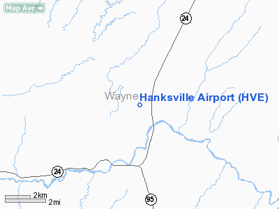
Location & QuickFacts
| FAA Information Effective: | 2008-09-25 |
| Airport Identifier: | HVE |
| Airport Status: | Operational |
| Longitude/Latitude: | 110-42-14.5360W/38-25-04.9340N
-110.704038/38.418037 (Estimated) |
| Elevation: | 4444 ft / 1354.53 m (Surveyed) |
| Land: | 765 acres |
| From nearest city: | 3 nautical miles N of Hanksville, UT |
| Location: | Wayne County, UT |
| Magnetic Variation: | 14E (1985) |
Owner & Manager
| Ownership: | Publicly owned |
| Owner: | Utah Division Of Aeronautics |
| Address: | 135 N 2400 W
Salt Lake City, UT 84116 |
| Phone number: | 801-715-2260 |
| Manager: | 9 |
| Address: | Po Box 126
Hanksville, UT 84734 |
| Phone number: | 435-542-1005
ALTERNATE NUMBER 801-372-6513. |
Airport Operations and Facilities
| Airport Use: | Open to public |
| Wind indicator: | Yes |
| Segmented Circle: | No |
| Control Tower: | No |
| Lighting Schedule: | DUSK-DAWN |
| Beacon Color: | Clear-Green (lighted land airport) |
| Landing fee charge: | No |
| Sectional chart: | Denver |
| Region: | ANM - Northwest Mountain |
| Boundary ARTCC: | ZLC - Salt Lake City |
| Tie-in FSS: | CDC - Cedar City |
| FSS on Airport: | No |
| FSS Toll Free: | 1-800-WX-BRIEF |
| NOTAMs Facility: | CDC (NOTAM-d service avaliable) |
| Federal Agreements: | N |
Airport Communications
| CTAF: | 122.800 |
| Unicom: | 122.800
UNICOM OTS INDEFLY. |
Airport Services
| Airframe Repair: | NONE |
| Power Plant Repair: | NONE |
| Bottled Oxygen: | NONE |
| Bulk Oxygen: | NONE |
Runway Information
Runway 08/26
| Dimension: | 5675 x 75 ft / 1729.7 x 22.9 m |
| Surface: | ASPH, Poor Condition
RY 08/26 BLOCK CRACKING & WEATHERING.
RY 17/35 VERY SOFT WHEN WET. |
| Weight Limit: | Single wheel: 12500 lbs. |
| Edge Lights: | Non-standard lighting system
RWY 08/26 NSTD LIRL; RY LGTS 200 FT FM RY EDGE. |
| |
Runway 08 |
Runway 26 |
| Longitude: | 110-42-50.5400W | 110-41-39.8100W |
| Latitude: | 38-24-59.9300N | 38-24-52.8500N |
| Elevation: | 4446.00 ft | 4423.00 ft |
| Traffic Pattern: | Left | Left |
| Markings: | Basic, Fair Condition | Basic, Fair Condition |
| Displaced threshold: | 600.00 ft
DSPLCD THR PAINTED BUT NOT LGTD. | 600.00 ft
DSPLCD THR PAINTED BUT NOT LGTD. |
| Obstruction: | , 50:1 slope to clear
RWY 08 +5 FT FENCE 100 FT FM PAVEMENT. | 18 ft road, 205.0 ft from runway
RY 26 APCH RATIO 44:1 TO DSPLCD THLD.
RWY 26 +5 FT FENCE 135 FT FM PAVEMENT. |
|
Runway 17/35
| Dimension: | 2600 x 120 ft / 792.5 x 36.6 m |
| Surface: | DIRT, Fair Condition
RY 08/26 BLOCK CRACKING & WEATHERING.
RY 17/35 VERY SOFT WHEN WET. |
| |
Runway 17 |
Runway 35 |
| Longitude: | 110-42-02.5400W | 110-42-04.7700W |
| Latitude: | 38-25-22.9300N | 38-24-57.2900N |
| Elevation: | 4437.00 ft | 4429.00 ft |
| Traffic Pattern: | Left | Left |
| Obstruction: | , 50:1 slope to clear | 8 ft fence, 180.0 ft from runway, 22:1 slope to clear |
|
Radio Navigation Aids
| ID |
Type |
Name |
Ch |
Freq |
Var |
Dist |
| OAB | VOR/DME | Moab | 035X | 109.80 | 15E | 49.2 nm |
| HVE | VORTAC | Hanksville | 106X | 115.90 | 15E | 0.2 nm |
Remarks
- PRVDD RWY 17/35 IS RSTRD TO LNDG NORTH AND TKOF TO THE SOUTH ONLY.
Images and information placed above are from
http://www.airport-data.com/airport/HVE/
We thank them for the data!
| General Info
|
| Country |
United States
|
| State |
UTAH
|
| FAA ID |
HVE
|
| Latitude |
38-25-04.934N
|
| Longitude |
110-42-14.536W
|
| Elevation |
4444 feet
|
| Near City |
HANKSVILLE
|
We don't guarantee the information is fresh and accurate. The data may
be wrong or outdated.
For more up-to-date information please refer to other sources.
|
|


