 |
|
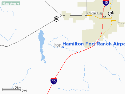
Hamilton Fort Ranch Airport |
Location & QuickFacts
| FAA Information Effective: | 2008-09-25 |
| Airport Identifier: | UT80 |
| Airport Status: | Operational |
| Longitude/Latitude: | 113-09-33.8200W/37-38-04.9100N
-113.159394/37.634697 (Estimated) |
| Elevation: | 5460 ft / 1664.21 m (Estimated) |
| Land: | 240 acres |
| From nearest city: | 6 nautical miles SW of Cedar City, UT |
| Location: | Iron County, UT |
| Magnetic Variation: | 14E (1995) |
Owner & Manager
| Ownership: | Privately owned |
| Owner: | Hamilton Fort Home Owners Assoc |
| Address: | 2929 South 6500 West
Cedar City, UT 84720 |
| Phone number: | 801-586-0658 |
| Manager: | Jonathan Allen |
| Address: | 2929 South 6500 West
Cedar City, UT 84720 |
| Phone number: | 801-586-0658 |
Airport Operations and Facilities
| Airport Use: | Private |
| Wind indicator: | Yes |
| Segmented Circle: | No |
| Control Tower: | No |
| Sectional chart: | Las Vegas |
| Region: | ANM - Northwest Mountain |
| Boundary ARTCC: | ZLC - Salt Lake City |
| Tie-in FSS: | CDC - Cedar City |
| FSS Toll Free: | 1-800-WX-BRIEF |
Airport Communications
Runway Information
Runway 18/36
| Dimension: | 4100 x 70 ft / 1249.7 x 21.3 m |
| Surface: | TURF, Fair Condition |
| |
Runway 18 |
Runway 36 |
| Traffic Pattern: | Right | Left |
|
Radio Navigation Aids
| ID |
Type |
Name |
Ch |
Freq |
Var |
Dist |
| AZC | NDB | Colorado City | | 403.00 | 13E | 41.2 nm |
| CDC | VOR/DME | Cedar City | 120X | 117.30 | 16E | 10.1 nm |
| OZN | VOR/DME | St George | 035X | 109.80 | 15E | 38.8 nm |
| BCE | VORTAC | Bryce Canyon | 075X | 112.80 | 15E | 40.8 nm |
| MLF | VORTAC | Milford | 058X | 112.10 | 16E | 44.2 nm |
Remarks
- 400 FT LGT TOWER LCTD 3 NM SOUTH OF ARPT.
- PRVDD VFR ONLY, COORDINATE OPNS WTH AMGR CEDAR CITY ARPT.
Images and information placed above are from
http://www.airport-data.com/airport/UT80/
We thank them for the data!
| General Info
|
| Country |
United States
|
| State |
UTAH
|
| FAA ID |
UT80
|
| Latitude |
37-38-04.910N
|
| Longitude |
113-09-33.820W
|
| Elevation |
5460 feet
|
| Near City |
CEDAR CITY
|
We don't guarantee the information is fresh and accurate. The data may
be wrong or outdated.
For more up-to-date information please refer to other sources.
|
|


