 |
|
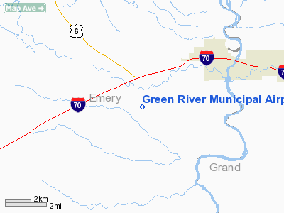
Location & QuickFacts
| FAA Information Effective: | 2008-09-25 |
| Airport Identifier: | U34 |
| Airport Status: | Operational |
| Longitude/Latitude: | 110-13-38.5030W/38-57-40.9020N
-110.227362/38.961362 (Estimated) |
| Elevation: | 4225 ft / 1287.78 m (Surveyed) |
| Land: | 517 acres |
| From nearest city: | 4 nautical miles SW of Green River, UT |
| Location: | Emery County, UT |
| Magnetic Variation: | 14E (1985) |
Owner & Manager
| Ownership: | Publicly owned |
| Owner: | Green River City Corp |
| Address: | 240 E. Main St., P.o. Box 620
Green River, UT 84525 |
| Phone number: | 435-564-3448 |
| Manager: | Trent Fluckey |
| Address: | P.o. Box 300
Green River, UT 84525 |
| Phone number: | 435-564-8383 |
Airport Operations and Facilities
| Airport Use: | Open to public |
| Wind indicator: | Yes |
| Segmented Circle: | Yes |
| Control Tower: | No |
| Lighting Schedule: | DUSK-DAWN
ACTVT MIRL RY 13/31, REIL & PAPI RYS 13 & 31 - CTAF. |
| Beacon Color: | Clear-Green (lighted land airport) |
| Landing fee charge: | No |
| Sectional chart: | Denver |
| Region: | ANM - Northwest Mountain |
| Boundary ARTCC: | ZLC - Salt Lake City |
| Tie-in FSS: | CDC - Cedar City |
| FSS on Airport: | No |
| FSS Toll Free: | 1-800-WX-BRIEF |
| NOTAMs Facility: | CDC (NOTAM-d service avaliable) |
| Federal Agreements: | NGY |
Airport Communications
| CTAF: | 122.800 |
| Unicom: | 122.800 |
Airport Services
| Fuel available: | 100LL |
| Airframe Repair: | MAJOR |
| Power Plant Repair: | MAJOR |
| Bottled Oxygen: | NONE |
| Bulk Oxygen: | NONE |
Runway Information
Runway 13/31
| Dimension: | 5600 x 75 ft / 1706.9 x 22.9 m |
| Surface: | ASPH, Good Condition |
| Weight Limit: | Single wheel: 12000 lbs. |
| Edge Lights: | Medium |
| |
Runway 13 |
Runway 31 |
| Traffic Pattern: | Left | Left |
| Markings: | Non-precision instrument, Fair Condition
RUNWAY 13/31 MARKINGS FADED. | Non-precision instrument, Fair Condition |
| Crossing Height: | 40.00 ft | 40.00 ft |
| VASI: | 2-light PAPI on left side | 2-light PAPI on left side |
| Visual Glide Angle: | 3.00° | 3.00° |
| Runway End Identifier: | Yes | Yes |
|
Radio Navigation Aids
| ID |
Type |
Name |
Ch |
Freq |
Var |
Dist |
| OAB | VOR/DME | Moab | 035X | 109.80 | 15E | 25.5 nm |
| PUC | VOR/DME | Carbon | 102X | 115.50 | 14E | 45.7 nm |
| HVE | VORTAC | Hanksville | 106X | 115.90 | 15E | 39.5 nm |
Remarks
Images and information placed above are from
http://www.airport-data.com/airport/U34/
We thank them for the data!
| General Info
|
| Country |
United States
|
| State |
UTAH
|
| FAA ID |
U34
|
| Latitude |
38-57-40.902N
|
| Longitude |
110-13-38.503W
|
| Elevation |
4225 feet
|
| Near City |
GREEN RIVER
|
We don't guarantee the information is fresh and accurate. The data may
be wrong or outdated.
For more up-to-date information please refer to other sources.
|
|


