 |
|
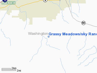
Grassy Meadows/sky Ranch Landowners Assn Airport |
Location & QuickFacts
| FAA Information Effective: | 2008-09-25 |
| Airport Identifier: | UT47 |
| Airport Status: | Operational |
| Longitude/Latitude: | 113-18-49.8170W/37-06-06.9390N
-113.313838/37.101928 (Estimated) |
| Elevation: | 3350 ft / 1021.08 m (Estimated) |
| Land: | 29 acres |
| From nearest city: | 4 nautical miles S of Hurricane, UT |
| Location: | Washington County, UT |
| Magnetic Variation: | 14E (1985) |
Owner & Manager
| Ownership: | Privately owned |
| Owner: | Grassy Meadows Arpt, Inc. |
| Address: | C/o M. Longley P.o. Box 51
Hurricane, UT 84737 |
| Phone number: | 435-635-4460 |
| Manager: | David Morrison |
| Address: | 4210 S 1100 W.
Hurricane, UT 84737
GRASSY MEADOWS SKY RANCH LAND OWNERS INC. |
| Phone number: | 435-635-4443 |
Airport Operations and Facilities
| Airport Use: | Private |
| Wind indicator: | Yes |
| Segmented Circle: | Yes |
| Control Tower: | No |
| Lighting Schedule: | RDO-CTL
ACTVT MIRL RY N/S - 123.05. |
| Landing fee charge: | No |
| Sectional chart: | Las Vegas |
| Region: | ANM - Northwest Mountain |
| Boundary ARTCC: | ZLA - Los Angeles |
| Tie-in FSS: | CDC - Cedar City |
| FSS on Airport: | No |
| FSS Toll Free: | 1-800-WX-BRIEF |
Airport Communications
Runway Information
Runway N/S
| Dimension: | 4400 x 50 ft / 1341.1 x 15.2 m |
| Surface: | ASPH, |
| Edge Lights: | Medium |
| |
Runway N |
Runway S |
| Traffic Pattern: | Left | Right |
|
Radio Navigation Aids
| ID |
Type |
Name |
Ch |
Freq |
Var |
Dist |
| AZC | NDB | Colorado City | | 403.00 | 13E | 16.9 nm |
| OZN | VOR/DME | St George | 035X | 109.80 | 15E | 13.4 nm |
| CDC | VOR/DME | Cedar City | 120X | 117.30 | 16E | 42.8 nm |
Remarks
- PROVIDED PILOTS ARE BRIEFED REGARDING ARPT PECULIARITIES AND TFC PATTERNS; WRITTEN AGREEMENT WITH HURRICANE MUNI ARPT REGARDING TFC PATTERNS; SEPARATION BTN ACFT & VEHICLE TFC AREAS.
Images and information placed above are from
http://www.airport-data.com/airport/UT47/
We thank them for the data!
| General Info
|
| Country |
United States
|
| State |
UTAH
|
| FAA ID |
UT47
|
| Latitude |
37-06-06.939N
|
| Longitude |
113-18-49.817W
|
| Elevation |
3350 feet
|
| Near City |
HURRICANE
|
We don't guarantee the information is fresh and accurate. The data may
be wrong or outdated.
For more up-to-date information please refer to other sources.
|
|


