 |
|
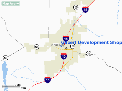
Gilbert Development Shop Heliport |
Location & QuickFacts
| FAA Information Effective: | 2008-09-25 |
| Airport Identifier: | UT12 |
| Airport Status: | Operational |
| Longitude/Latitude: | 113-05-07.8160W/37-41-14.9160N
-113.085504/37.687477 (Estimated) |
| Elevation: | 5670 ft / 1728.22 m (Estimated) |
| Land: | 0 acres |
| From nearest city: | 1 nautical miles N of Cedar City, UT |
| Location: | Iron County, UT |
| Magnetic Variation: | 14E (1985) |
Owner & Manager
| Ownership: | Privately owned |
| Owner: | Gilbert Development Corp.
STEVE L. GILBERT 435-586-5138 |
| Address: | P.o. Box 665
Cedar City, UT 84720 |
| Phone number: | 435-586-5138 |
| Address: |
|
Airport Operations and Facilities
| Airport Use: | Private |
| Segmented Circle: | No |
| Control Tower: | No |
| Sectional chart: | Salt Lake City |
| Region: | ANM - Northwest Mountain |
| Boundary ARTCC: | ZLC - Salt Lake City |
| Tie-in FSS: | CDC - Cedar City |
| FSS Toll Free: | 1-800-WX-BRIEF |
Runway Information
Helipad H1
| Dimension: | 30 x 30 ft / 9.1 x 9.1 m |
| Surface: | CONC, |
| |
Runway H1 |
Runway |
| Traffic Pattern: | Left | Left |
|
Radio Navigation Aids
| ID |
Type |
Name |
Ch |
Freq |
Var |
Dist |
| AZC | NDB | Colorado City | | 403.00 | 13E | 43.9 nm |
| CDC | VOR/DME | Cedar City | 120X | 117.30 | 16E | 6.1 nm |
| OZN | VOR/DME | St George | 035X | 109.80 | 15E | 43.4 nm |
| BCE | VORTAC | Bryce Canyon | 075X | 112.80 | 15E | 37.2 nm |
| MLF | VORTAC | Milford | 058X | 112.10 | 16E | 40.6 nm |
Remarks
- PRVDD CLEAR 8:1 APCH/DEP PATHS ARE ESTB & MAINTD.
Images and information placed above are from
http://www.airport-data.com/airport/UT12/
We thank them for the data!
| General Info
|
| Country |
United States
|
| State |
UTAH
|
| FAA ID |
UT12
|
| Latitude |
37-41-14.916N
|
| Longitude |
113-05-07.816W
|
| Elevation |
5670 feet
|
| Near City |
CEDAR CITY
|
We don't guarantee the information is fresh and accurate. The data may
be wrong or outdated.
For more up-to-date information please refer to other sources.
|
|


