 |
|
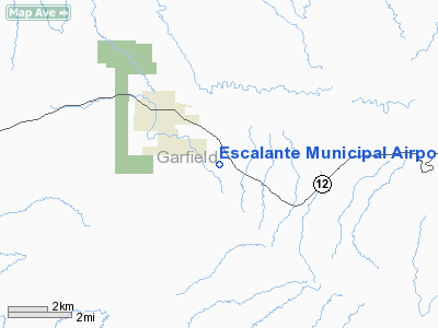
Location & QuickFacts
| FAA Information Effective: | 2008-09-25 |
| Airport Identifier: | 1L7 |
| Airport Status: | Operational |
| Longitude/Latitude: | 111-34-12.5950W/37-44-43.1750N
-111.570165/37.745326 (Estimated) |
| Elevation: | 5733 ft / 1747.42 m (Estimated) |
| Land: | 163 acres |
| From nearest city: | 2 nautical miles SE of Escalante, UT |
| Location: | Garfield County, UT |
| Magnetic Variation: | 14E (1985) |
Owner & Manager
| Ownership: | Publicly owned |
| Owner: | Escalante City |
| Address: | 56 N. 100 W., Po Box 189
Escalante, UT 84726 |
| Phone number: | 435-826-4644 |
| Manager: | Don Porter |
| Address: | Po Box 189
Escalante, UT 84726 |
| Phone number: | 435-826-4644 |
Airport Operations and Facilities
| Airport Use: | Open to public |
| Wind indicator: | Yes |
| Segmented Circle: | Yes |
| Control Tower: | No |
| Lighting Schedule: | DUSK-DAWN
ACTVT MIRL RY 13/31 - CTAF. |
| Beacon Color: | Clear-Green (lighted land airport) |
| Landing fee charge: | No |
| Sectional chart: | Las Vegas |
| Region: | ANM - Northwest Mountain |
| Boundary ARTCC: | ZLC - Salt Lake City |
| Tie-in FSS: | CDC - Cedar City |
| FSS on Airport: | No |
| FSS Toll Free: | 1-800-WX-BRIEF |
| NOTAMs Facility: | CDC (NOTAM-d service avaliable) |
| Federal Agreements: | NSY1 |
Airport Communications
| CTAF: | 122.800 |
| Unicom: | 122.800 |
Airport Services
| Airframe Repair: | NONE |
| Power Plant Repair: | NONE |
| Bottled Oxygen: | NONE |
| Bulk Oxygen: | NONE |
Runway Information
Runway 13/31
| Dimension: | 5000 x 60 ft / 1524.0 x 18.3 m |
| Surface: | ASPH, Fair Condition
RY 31 HAS A DIP APPROX MID-FIELD. |
| Weight Limit: | Single wheel: 12500 lbs. |
| Edge Lights: | Medium
RY 13/31 NUMEROUS RY LGTS BROKEN. |
| |
Runway 13 |
Runway 31 |
| Longitude: | 111-34-32.8200W | 111-33-52.3700W |
| Latitude: | 37-45-01.9600N | 37-44-24.3900N |
| Elevation: | 5733.00 ft | 5714.00 ft |
| Alignment: | 127 | 127 |
| Traffic Pattern: | Right | Left |
| Markings: | Basic, Poor Condition
RY 31 MARKINGS STRIPED & MARKERS FADED. | Basic, Poor Condition |
| Obstruction: | , 50:1 slope to clear
+4 FT KNOLL 20 FT FM RY EDGE 95 FT L OF CNTRLN. | 22 ft hill, 1080.0 ft from runway, 40:1 slope to clear
5 FT MOUNDS OF DIRT 30 FT L OF CNTRLN. |
|
Radio Navigation Aids
| ID |
Type |
Name |
Ch |
Freq |
Var |
Dist |
| PGA | VOR/DME | Page | 123X | 117.60 | 13E | 49.3 nm |
| BCE | VORTAC | Bryce Canyon | 075X | 112.80 | 15E | 35.0 nm |
Remarks
- CLSD LNDG STRIP IS USED FOR STATE HWY MIX; FM AIR IT LOOKS LIKE A RY.
Images and information placed above are from
http://www.airport-data.com/airport/1L7/
We thank them for the data!
| General Info
|
| Country |
United States
|
| State |
UTAH
|
| FAA ID |
1L7
|
| Latitude |
37-44-43.175N
|
| Longitude |
111-34-12.595W
|
| Elevation |
5740 feet
|
| Near City |
ESCALANTE
|
We don't guarantee the information is fresh and accurate. The data may
be wrong or outdated.
For more up-to-date information please refer to other sources.
|
|


