 |
|
Location & QuickFacts
| FAA Information Effective: | 2008-09-25 |
| Airport Identifier: | 33U |
| Airport Status: | Operational |
| Longitude/Latitude: | 109-23-26.4860W/40-55-03.8540N
-109.390691/40.917737 (Estimated) |
| Elevation: | 6561 ft / 1999.79 m (Estimated) |
| Land: | 296 acres |
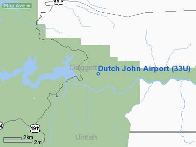
| From nearest city: | 1 nautical miles SW of Dutch John, UT |
| Location: | Daggett County, UT |
| Magnetic Variation: | 14E (1985) |
Owner & Manager
| Ownership: | Publicly owned |
| Owner: | Daggett County
AREA RANGER - CRAIG SHELEY 801-784-3445 |
| Address: | 95 N. 1st W., P.o. Box 219
Manila, UT 84046-0219 |
| Phone number: | 435-784-3154 |
| Manager: | Floyd Briggs
LOCAL CONTACT - JESSIE SLAUGH 435-880-7991 OR WESLEY SLAUGH 435-880-7054 |
| Address: | P.o. Box 219
Manila, UT 84046 |
| Phone number: | 435-784-3154 |
Airport Operations and Facilities
| Airport Use: | Open to public |
| Wind indicator: | Yes |
| Segmented Circle: | Yes |
| Control Tower: | No |
| Landing fee charge: | No |
| Sectional chart: | Salt Lake City |
| Region: | ANM - Northwest Mountain |
| Boundary ARTCC: | ZLC - Salt Lake City |
| Tie-in FSS: | CDC - Cedar City |
| FSS on Airport: | No |
| FSS Toll Free: | 1-800-WX-BRIEF |
| NOTAMs Facility: | CDC (NOTAM-d service avaliable) |
Airport Communications
Airport Services
| Airframe Repair: | NONE |
| Power Plant Repair: | NONE |
| Bottled Oxygen: | NONE |
| Bulk Oxygen: | NONE |
Runway Information
Runway 03/21
| Dimension: | 4650 x 150 ft / 1417.3 x 45.7 m |
| Surface: | TURF-DIRT, Poor Condition
RWY 03/21 NOT MAINTAINED; NUMEROUS RODENT HOLES; NUMEROUS TREES ON APCH ENDS.
RWY 07/25 NOT MAINTAINED; NUMEROUS RODENT HOLES; NUMEROUS TREES ON APCH ENDS.
SEVERAL AREAS OF DAMAGED PAVEMENT LOCATED ON THE NORTH EDGE OF THE RUNWAY. |
| |
Runway 03 |
Runway 21 |
| Traffic Pattern: | Left | Left |
|
Runway 07/25
| Dimension: | 4450 x 100 ft / 1356.4 x 30.5 m |
| Surface: | TURF-DIRT, Poor Condition
RWY 03/21 NOT MAINTAINED; NUMEROUS RODENT HOLES; NUMEROUS TREES ON APCH ENDS.
RWY 07/25 NOT MAINTAINED; NUMEROUS RODENT HOLES; NUMEROUS TREES ON APCH ENDS.
SEVERAL AREAS OF DAMAGED PAVEMENT LOCATED ON THE NORTH EDGE OF THE RUNWAY. |
| |
Runway 07 |
Runway 25 |
| Traffic Pattern: | Left | Left |
|
Runway 11/29
| Dimension: | 6600 x 60 ft / 2011.7 x 18.3 m |
| Surface: | ASPH, Poor Condition
RWY 03/21 NOT MAINTAINED; NUMEROUS RODENT HOLES; NUMEROUS TREES ON APCH ENDS.
RWY 07/25 NOT MAINTAINED; NUMEROUS RODENT HOLES; NUMEROUS TREES ON APCH ENDS.
SEVERAL AREAS OF DAMAGED PAVEMENT LOCATED ON THE NORTH EDGE OF THE RUNWAY. |
| |
Runway 11 |
Runway 29 |
| Traffic Pattern: | Left | Left |
| Markings: | Basic, Fair Condition | Basic, Fair Condition |
| Obstruction: | 37 ft pole, 909.0 ft from runway, 120 ft left of centerline, 19:1 slope to clear
RWY 11, +15 FT ROAD, 135 FT FROM RUNWAY END. | 19 ft trees, 333.0 ft from runway, 89 ft left of centerline, 7:1 slope to clear
+15 FT TREE, 112 FT FROM RWY END, 75 FT R. |
|
Radio Navigation Aids
| ID |
Type |
Name |
Ch |
Freq |
Var |
Dist |
| AOP | NDB | Antelope | | 290.00 | 13E | 44.8 nm |
| VEL | VOR/DME | Vernal | 019X | 108.20 | 15E | 32.7 nm |
| OCS | VORTAC | Rock Springs | 107X | 116.00 | 13E | 43.8 nm |
Remarks
- DEER AND ELK ON AND INVOF ARPT.
- TWO CROSSING DIRT/TURF RYS APPEAR TO BE OPEN BUT ARE CLOSED & NOT MAINTAINED.
- ACFT IN EXCESS OF 12,500 POUNDS MAXIMUM GROSS WEIGHT PROHIBITED FROM USING APRT.
Images and information placed above are from
http://www.airport-data.com/airport/33U/
We thank them for the data!
| General Info
|
| Country |
United States
|
| State |
UTAH
|
| FAA ID |
33U
|
| Latitude |
40-55-03.854N
|
| Longitude |
109-23-26.486W
|
| Elevation |
6561 feet
|
| Near City |
DUTCH JOHN
|
We don't guarantee the information is fresh and accurate. The data may
be wrong or outdated.
For more up-to-date information please refer to other sources.
|
|


