 |
|
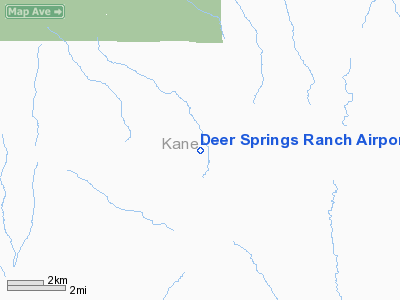
Deer Springs Ranch Airport |
Location & QuickFacts
| FAA Information Effective: | 2008-09-25 |
| Airport Identifier: | UT30 |
| Airport Status: | Operational |
| Longitude/Latitude: | 112-13-24.6980W/37-20-32.9330N
-112.223527/37.342481 (Estimated) |
| Elevation: | 6485 ft / 1976.63 m (Estimated) |
| Land: | 0 acres |
| From nearest city: | 23 nautical miles NE of Kanab, UT |
| Location: | Kane County, UT |
| Magnetic Variation: | 14E (1985) |
Owner & Manager
| Ownership: | Privately owned |
| Owner: | Deer Sprgs Ranch Owners Assoc |
| Address: | 30 East Center
Kanab, UT 84741 |
| Phone number: | 801-644-2607 |
| Manager: | Leo Weber |
| Address: | 30 East Center
Kanab, UT 84741 |
| Phone number: | 801-644-2607 |
Airport Operations and Facilities
| Airport Use: | Private |
| Wind indicator: | Yes |
| Segmented Circle: | No |
| Control Tower: | No |
| Landing fee charge: | No |
| Sectional chart: | Las Vegas |
| Region: | ANM - Northwest Mountain |
| Boundary ARTCC: | ZLA - Los Angeles |
| Tie-in FSS: | CDC - Cedar City |
| FSS on Airport: | No |
| FSS Toll Free: | 1-800-WX-BRIEF |
Runway Information
Runway 17/35
| Dimension: | 8920 x 30 ft / 2718.8 x 9.1 m |
| Surface: | DIRT, |
| |
Runway 17 |
Runway 35 |
| Traffic Pattern: | Left | Left |
| Obstruction: | 30 ft trees | 30 ft trees |
|
Radio Navigation Aids
| ID |
Type |
Name |
Ch |
Freq |
Var |
Dist |
| AZC | NDB | Colorado City | | 403.00 | 13E | 44.1 nm |
| PGA | VOR/DME | Page | 123X | 117.60 | 13E | 44.7 nm |
| CDC | VOR/DME | Cedar City | 120X | 117.30 | 16E | 48.3 nm |
| BCE | VORTAC | Bryce Canyon | 075X | 112.80 | 15E | 21.2 nm |
Remarks
- FOR RECORD PURPOSES ONLY.
Images and information placed above are from
http://www.airport-data.com/airport/UT30/
We thank them for the data!
| General Info
|
| Country |
United States
|
| State |
UTAH
|
| FAA ID |
UT30
|
| Latitude |
37-20-32.933N
|
| Longitude |
112-13-24.698W
|
| Elevation |
6485 feet
|
| Near City |
KANAB
|
We don't guarantee the information is fresh and accurate. The data may
be wrong or outdated.
For more up-to-date information please refer to other sources.
|
|


