 |
|
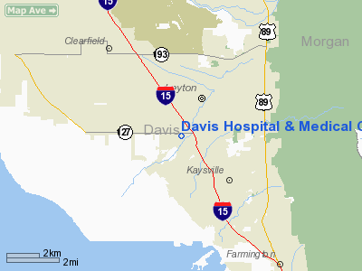
Davis Hospital & Medical Center Heliport |
Location & QuickFacts
| FAA Information Effective: | 2008-09-25 |
| Airport Identifier: | UT44 |
| Airport Status: | Operational |
| Longitude/Latitude: | 111-58-17.7890W/41-03-29.7970N
-111.971608/41.058277 (Estimated) |
| Elevation: | 4300 ft / 1310.64 m (Estimated) |
| Land: | 0 acres |
| From nearest city: | 0 nautical miles E of Layton, UT |
| Location: | Davis County, UT |
| Magnetic Variation: | 15E (1985) |
Owner & Manager
| Ownership: | Privately owned |
| Owner: | Davis Hosp & Med Center |
| Address: | 1600 West Antelope Drive
Layton, UT 84041 |
| Phone number: | 801-807-1000 |
| Manager: | Michael Jensen |
| Address: | 1600 West Antelope Drive
Layton, UT 84041 |
| Phone number: | 801-807-7006 |
Airport Operations and Facilities
| Airport Use: | Private
MEDICAL USE. |
| Wind indicator: | Yes |
| Segmented Circle: | No |
| Control Tower: | No |
| Landing fee charge: | No |
| Sectional chart: | Salt Lake City |
| Region: | ANM - Northwest Mountain |
| Boundary ARTCC: | ZLC - Salt Lake City |
| Tie-in FSS: | CDC - Cedar City |
| FSS on Airport: | No |
| FSS Toll Free: | 1-800-WX-BRIEF |
Runway Information
Helipad H1
| Dimension: | 25 x 25 ft / 7.6 x 7.6 m |
| Surface: | CONC, |
| |
Runway H1 |
Runway |
| Traffic Pattern: | Left | Left |
|
Radio Navigation Aids
| ID |
Type |
Name |
Ch |
Freq |
Var |
Dist |
| BMC | NDB | Brigham City | | 294.00 | 16E | 27.9 nm |
| TVY | NDB | Tooele | | 371.00 | 13E | 31.9 nm |
| HIF | TACAN | Hill | 049X | | 14E | 3.8 nm |
| EVW | VOR/DME | Evanston | 33X | 109.60 | 13E | 43.8 nm |
| LHO | VOR/DME | Brigham City | 076X | 112.90 | 14E | 44.2 nm |
| LGU | VOR/DME | Logan | 035X | 109.80 | 16E | 47.5 nm |
| OGD | VORTAC | Ogden | 104X | 115.70 | 14E | 11.5 nm |
| TCH | VORTAC | Wasatch | 115X | 116.80 | 16E | 12.5 nm |
| FFU | VORTAC | Fairfield | 113X | 116.60 | 16E | 47.1 nm |
| SLC | VOT | Salt Lake City | | 111.00 | | 26.3 nm |
Images and information placed above are from
http://www.airport-data.com/airport/UT44/
We thank them for the data!
| General Info
|
| Country |
United States
|
| State |
UTAH
|
| FAA ID |
UT44
|
| Latitude |
41-03-29.797N
|
| Longitude |
111-58-17.789W
|
| Elevation |
4300 feet
|
| Near City |
LAYTON
|
We don't guarantee the information is fresh and accurate. The data may
be wrong or outdated.
For more up-to-date information please refer to other sources.
|
|


