 |
|
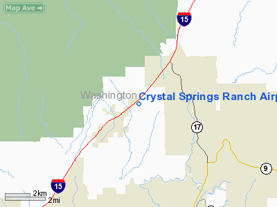
Crystal Springs Ranch Airport |
Location & QuickFacts
| FAA Information Effective: | 2008-09-25 |
| Airport Identifier: | UT54 |
| Airport Status: | Operational |
| Longitude/Latitude: | 113-20-02.8170W/37-15-11.9350N
-113.334116/37.253315 (Estimated) |
| Elevation: | 3671 ft / 1118.92 m (Surveyed) |
| Land: | 0 acres |
| From nearest city: | 1 nautical miles NE of Leeds, UT |
| Location: | Washington County, UT |
| Magnetic Variation: | 14E (1985) |
Owner & Manager
| Ownership: | Privately owned |
| Owner: | Alan L. Howard |
| Address: | P.o. Box 460630
Leeds, UT 84746 |
| Phone number: | 801-879-2215 |
| Manager: | Alan L. Howard |
| Address: | 950 North Main St.
Leeds, UT 84746 |
| Phone number: | 801-879-2215 |
Airport Operations and Facilities
| Airport Use: | Private |
| Wind indicator: | Yes |
| Segmented Circle: | No |
| Control Tower: | No |
| Sectional chart: | Las Vegas |
| Region: | ANM - Northwest Mountain |
| Boundary ARTCC: | ZLA - Los Angeles |
| Tie-in FSS: | CDC - Cedar City |
| FSS on Airport: | No |
| FSS Toll Free: | 1-800-WX-BRIEF |
Runway Information
Runway 03/21
| Dimension: | 2600 x 80 ft / 792.5 x 24.4 m |
| Surface: | DIRT, |
| |
Runway 03 |
Runway 21 |
| Traffic Pattern: | Left | Left |
| Obstruction: | 25 ft pline, 500.0 ft from runway | 25 ft pline, 1000.0 ft from runway |
|
Radio Navigation Aids
| ID |
Type |
Name |
Ch |
Freq |
Var |
Dist |
| AZC | NDB | Colorado City | | 403.00 | 13E | 23.5 nm |
| OZN | VOR/DME | St George | 035X | 109.80 | 15E | 15.8 nm |
| CDC | VOR/DME | Cedar City | 120X | 117.30 | 16E | 34.5 nm |
Images and information placed above are from
http://www.airport-data.com/airport/UT54/
We thank them for the data!
| General Info
|
| Country |
United States
|
| State |
UTAH
|
| FAA ID |
UT54
|
| Latitude |
37-15-11.935N
|
| Longitude |
113-20-02.817W
|
| Elevation |
3671 feet
|
| Near City |
LEEDS
|
We don't guarantee the information is fresh and accurate. The data may
be wrong or outdated.
For more up-to-date information please refer to other sources.
|
|


