 |
|
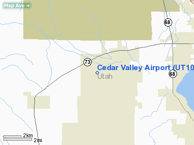
Location & QuickFacts
| FAA Information Effective: | 2008-09-25 |
| Airport Identifier: | UT10 |
| Airport Status: | Operational |
| Longitude/Latitude: | 112-01-04.0000W/40-21-26.0000N
-112.017778/40.357222 (Estimated) |
| Elevation: | 5000 ft / 1524.00 m (Estimated) |
| Land: | 0 acres |
| From nearest city: | 5 nautical miles NE of Cedar Fort, UT |
| Location: | Utah County, UT |
| Magnetic Variation: | 15E (1985) |
Owner & Manager
| Ownership: | Privately owned |
| Owner: | John R Adkins |
| Address: | 3721 Lois Lane
Salt Lake City, UT 84124 |
| Phone number: | 801-466-5859 |
| Manager: | John R Adkins |
| Address: | 3721 Lois Lane
Salt Lake City, UT 84124 |
| Phone number: | 801-768-9054 |
Airport Operations and Facilities
| Airport Use: | Private |
| Wind indicator: | Yes |
| Segmented Circle: | No |
| Control Tower: | No |
| Landing fee charge: | No |
| Sectional chart: | Salt Lake City |
| Region: | ANM - Northwest Mountain |
| Boundary ARTCC: | ZLC - Salt Lake City |
| Tie-in FSS: | CDC - Cedar City |
| FSS on Airport: | No |
| FSS Toll Free: | 1-800-WX-BRIEF |
Runway Information
Runway 17/35
| Dimension: | 5100 x 100 ft / 1554.5 x 30.5 m |
| Surface: | GRAVEL, |
| |
Runway 17 |
Runway 35 |
| Traffic Pattern: | Right | Right |
|
Radio Navigation Aids
| ID |
Type |
Name |
Ch |
Freq |
Var |
Dist |
| TVY | NDB | Tooele | | 371.00 | 13E | 21.4 nm |
| DPG | NDB | Dugway | | 284.00 | 15E | 43.5 nm |
| MIJ | TACAN | Michael | 079X | | 15E | 42.7 nm |
| HIF | TACAN | Hill | 049X | | 14E | 45.9 nm |
| PVU | VOR/DME | Provo | 021X | 108.40 | 15E | 16.1 nm |
| FFU | VORTAC | Fairfield | 113X | 116.60 | 16E | 6.1 nm |
| TCH | VORTAC | Wasatch | 115X | 116.80 | 16E | 29.7 nm |
| SLC | VOT | Salt Lake City | | 111.00 | | 15.9 nm |
Remarks
- GLIDER ACTIVITY ON & INVOF ARPT.
Images and information placed above are from
http://www.airport-data.com/airport/UT10/
We thank them for the data!
| General Info
|
| Country |
United States
|
| State |
UTAH
|
| FAA ID |
UT10
|
| Latitude |
40-21-26.000N
|
| Longitude |
112-01-04.000W
|
| Elevation |
5000 feet
|
| Near City |
CEDAR FORT
|
We don't guarantee the information is fresh and accurate. The data may
be wrong or outdated.
For more up-to-date information please refer to other sources.
|
|


