 |
|
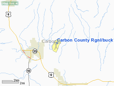
Carbon County Rgnl/buck Davis Field Airport |
Location & QuickFacts
| FAA Information Effective: | 2008-09-25 |
| Airport Identifier: | PUC |
| Airport Status: | Operational |
| Longitude/Latitude: | 110-45-05.2000W/39-36-50.1000N
-110.751444/39.613917 (Estimated) |
| Elevation: | 5957 ft / 1815.69 m (Surveyed) |
| Land: | 1147 acres |
| From nearest city: | 3 nautical miles E of Price, UT |
| Location: | Carbon County, UT |
| Magnetic Variation: | 14E (1985) |
Owner & Manager
| Ownership: | Publicly owned |
| Owner: | Carbon County |
| Address: | 120 E Main St.
Price, UT 84501 |
| Phone number: | 435-636-3226 |
| Manager: | Mark Francis |
| Address: | P.o.box 786, 3095 East Airport Road
Price, UT 84501 |
| Phone number: | 435-637-9556 |
Airport Operations and Facilities
| Airport Use: | Open to public |
| Wind indicator: | Yes |
| Segmented Circle: | No |
| Control Tower: | No |
| Lighting Schedule: | DUSK-DAWN
ACTVT MIRL RWYS 18/36 & 14/32 & REIL RWY 36 - CTAF. VASI RY 36 OPERS 24 HRS. |
| Beacon Color: | Clear-Green (lighted land airport) |
| Landing fee charge: | No |
| Sectional chart: | Denver |
| Region: | ANM - Northwest Mountain |
| Boundary ARTCC: | ZLC - Salt Lake City |
| Tie-in FSS: | CDC - Cedar City |
| FSS on Airport: | No |
| FSS Toll Free: | 1-800-WX-BRIEF |
| NOTAMs Facility: | PUC (NOTAM-d service avaliable) |
| Federal Agreements: | NGSY |
Airport Communications
| CTAF: | 122.800 |
| Unicom: | 122.800 |
Airport Services
| Fuel available: | 100LLA |
| Airframe Repair: | MINOR |
| Power Plant Repair: | MINOR |
| Bottled Oxygen: | NONE |
| Bulk Oxygen: | HIGH/LOW |
Runway Information
Runway 07/25
| Dimension: | 3541 x 75 ft / 1079.3 x 22.9 m |
| Surface: | ASPH, Poor Condition
RWY 07/25 PAVEMENT CRACKING & SEPARATING. |
| Weight Limit: | Single wheel: 12500 lbs. |
| |
Runway 07 |
Runway 25 |
| Longitude: | 110-45-24.3966W | 110-44-39.1473W |
| Latitude: | 39-36-54.4726N | 39-36-54.5527N |
| Elevation: | 5859.00 ft | 5892.00 ft |
| Alignment: | 90 | 127 |
| Traffic Pattern: | Left | Left |
| Markings: | Basic, Poor Condition
RWY 07 /25 MARKINGS FADED. | Basic, Poor Condition |
| Displaced threshold: | 0.00 ft | 228.00 ft |
| Obstruction: | , 50:1 slope to clear | 7 ft road, 250.0 ft from runway, 7:1 slope to clear
APCH SLOPE 35:1 TO DSPLCD THR.
+6 FT FENCE, 170 FT FRM RWY END |
|
Runway 14/32
| Dimension: | 4514 x 75 ft / 1375.9 x 22.9 m |
| Surface: | ASPH, Good Condition
RWY 07/25 PAVEMENT CRACKING & SEPARATING. |
| Weight Limit: | Single wheel: 13000 lbs. |
| Edge Lights: | Medium |
| |
Runway 14 |
Runway 32 |
| Longitude: | 110-45-24.2553W | 110-45-03.3132W |
| Latitude: | 39-36-55.3914N | 39-36-13.8258N |
| Elevation: | 5861.00 ft | 5812.00 ft |
| Alignment: | 127 | 127 |
| Traffic Pattern: | Left | Left |
| Markings: | Basic, Good Condition | Basic, Good Condition |
| Obstruction: | , 50:1 slope to clear | 11 ft road, 225.0 ft from runway, 2:1 slope to clear |
|
Runway 18/36
| Dimension: | 8313 x 100 ft / 2533.8 x 30.5 m |
| Surface: | ASPH, Good Condition
RWY 07/25 PAVEMENT CRACKING & SEPARATING. |
| Surface Treatment: | Porous Friction Course |
| Weight Limit: | Single wheel: 24000 lbs.
Dual wheel: 40000 lbs. |
| Edge Lights: | Medium |
| |
Runway 18 |
Runway 36 |
| Longitude: | 110-44-45.3074W | 110-45-18.7525W |
| Latitude: | 39-37-35.7040N | 39-36-17.7595N |
| Elevation: | 5957.00 ft | 5812.00 ft |
| Alignment: | 127 | 18 |
| Traffic Pattern: | Left | Left |
| Markings: | Basic, Fair Condition | Non-precision instrument, Fair Condition |
| Crossing Height: | 0.00 ft | 47.00 ft |
| VASI: | | 2-box on left side |
| Visual Glide Angle: | 0.00° | 2.50° |
| Runway End Identifier: | | Yes |
| Obstruction: | 38 ft fence, 1315.0 ft from runway, 29:1 slope to clear | , 50:1 slope to clear
+7' TREE 88' R OF CNTRLN EXTDD. |
|
Helipad H1
| Dimension: | 20 x 20 ft / 6.1 x 6.1 m |
| Surface: | CONC, Fair Condition
RWY 07/25 PAVEMENT CRACKING & SEPARATING. |
| |
Runway H1 |
Runway |
| Traffic Pattern: | Left | Left |
|
Helipad H2
| Dimension: | 20 x 20 ft / 6.1 x 6.1 m |
| Surface: | CONC, Fair Condition
RWY 07/25 PAVEMENT CRACKING & SEPARATING. |
| |
Runway H2 |
Runway |
| Traffic Pattern: | Left | Left |
|
Radio Navigation Aids
| ID |
Type |
Name |
Ch |
Freq |
Var |
Dist |
| PUC | VOR/DME | Carbon | 102X | 115.50 | 14E | 0.7 nm |
| MTU | VORTAC | Myton | 074X | 112.70 | 14E | 43.2 nm |
Remarks
- RY 14 END SAFETY AREA 140 FT FM APCH END.
- RY 32 END SAFETY AREA 150 FT FM APCH END.
Images and information placed above are from
http://www.airport-data.com/airport/PUC/
We thank them for the data!
| General Info
|
| Country |
United States
|
| State |
UTAH
|
| FAA ID |
PUC
|
| Latitude |
39-36-50.096N
|
| Longitude |
110-45-05.106W
|
| Elevation |
5953 feet
|
| Near City |
PRICE
|
We don't guarantee the information is fresh and accurate. The data may
be wrong or outdated.
For more up-to-date information please refer to other sources.
|
|


