 |
|
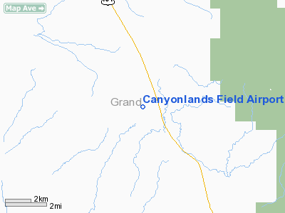
Canyonlands Field Airport |
| Canyonlands Field |
| IATA: CNY – ICAO: KCNY |
| Summary |
| Airport type |
Public |
| Operator |
Grand County |
| Location |
Moab, Utah |
| Elevation AMSL |
4,555 ft / 1,388.4 m |
| Coordinates |
38°45′18″N 109°45′17″W / 38.755°N 109.75472°W / 38.755; -109.75472Coordinates: 38°45′18″N 109°45′17″W / 38.755°N 109.75472°W / 38.755; -109.75472 |
| Runways |
| Direction |
Length |
Surface |
| ft |
m |
| 3/21 |
7,100 |
2,164 |
Asphalt |
Canyonlands Field (IATA: CNY, ICAO: KCNY) is a public airport located 18 miles (29 km) northwest of the central business district (CBD) of Moab, a city in Grand County, Utah, USA. The airport covers 985 acres (399 ha) and has one runway. It is mostly used for general aviation, but is served by one commercial airline. Service is subsidized by the Essential Air Service program.
Great Lakes Airlines began servicing the airport on January 6, 2007 with two daily flights to Denver International Airport. The airport has previously been served by Air Midwest and Salmon Air with service to Salt Lake City International Airport. Before Air Midwest and Salmon Air provided service to Moab Frontier Airlines (1950-1986) provided service, between 1958 till sometime between 1967 and 1979, probably 1972 or 1973 because a route map of SkyWest Airlines dated 1974 showed that they provided service from and by 1975 they were gone too.
Airlines and destinations
| Airlines |
Destinations |
| Great Lakes Airlines |
Denver, Ely |
The above content comes from Wikipedia and is published under free licenses – click here to read more.
Location & QuickFacts
| FAA Information Effective: | 2008-09-25 |
| Airport Identifier: | CNY |
| Airport Status: | Operational |
| Longitude/Latitude: | 109-45-17.4380W/38-45-17.8420N
-109.754844/38.754956 (Estimated) |
| Elevation: | 4555 ft / 1388.36 m (Estimated) |
| Land: | 985 acres |
| From nearest city: | 18 nautical miles NW of Moab, UT |
| Location: | Grand County, UT |
| Magnetic Variation: | 15E (1975) |
Owner & Manager
| Ownership: | Publicly owned |
| Owner: | Grand County |
| Address: | 125 E. Center
Moab, UT 84532 |
| Phone number: | 435-259-1321 |
| Manager: | Kelly Braun |
| Address: | 125 E. Center
Moab, UT 84532 |
| Phone number: | 435-259-4849 |
Airport Operations and Facilities
| Airport Use: | Open to public |
| Wind indicator: | Yes |
| Segmented Circle: | Yes |
| Control Tower: | No |
| Lighting Schedule: | RDO-CTL
ACTVT MIRL RY 03/21, PAPI RYS 03 & 21, & REIL RYS 03 & 21 - CTAF. |
| Beacon Color: | Clear-Green (lighted land airport) |
| Landing fee charge: | No |
| Sectional chart: | Denver |
| Region: | ANM - Northwest Mountain |
| Boundary ARTCC: | ZDV - Denver |
| Tie-in FSS: | CDC - Cedar City |
| FSS on Airport: | No |
| FSS Toll Free: | 1-800-WX-BRIEF |
| NOTAMs Facility: | CNY (NOTAM-d service avaliable) |
| Certification type/date: | III A S 06/20 |
| Federal Agreements: | NGSY |
Airport Communications
| CTAF: | 122.800 |
| Unicom: | 122.800 |
Airport Services
| Fuel available: | 100LLA |
| Airframe Repair: | MINOR |
| Power Plant Repair: | MINOR |
Runway Information
Runway 03/21
| Dimension: | 7100 x 75 ft / 2164.1 x 22.9 m |
| Surface: | ASPH, Good Condition |
| Surface Treatment: | Porous Friction Course |
| Weight Limit: | Single wheel: 25000 lbs. |
| Edge Lights: | Medium |
| |
Runway 03 |
Runway 21 |
| Longitude: | 109-45-46.1700W | 109-44-48.7070W |
| Latitude: | 38-44-50.9280N | 38-45-44.7550N |
| Elevation: | 4550.00 ft | 4554.00 ft |
| Alignment: | 40 | 127 |
| Traffic Pattern: | Left | Left |
| Markings: | Non-precision instrument, Good Condition | Non-precision instrument, Good Condition |
| Crossing Height: | 40.00 ft | 40.00 ft |
| VASI: | 2-light PAPI on left side | 2-light PAPI on left side |
| Runway End Identifier: | Yes | Yes |
| Obstruction: | , 50:1 slope to clear | 36 ft pline, 912.0 ft from runway, 464 ft left of centerline, 19:1 slope to clear |
|
Radio Navigation Aids
| ID |
Type |
Name |
Ch |
Freq |
Var |
Dist |
| OAB | VOR/DME | Moab | 035X | 109.80 | 15E | 0.3 nm |
| JNC | VORTAC | Grand Junction | 071X | 112.40 | 15E | 48.6 nm |
| HVE | VORTAC | Hanksville | 106X | 115.90 | 15E | 48.8 nm |
Images and information placed above are from
http://www.airport-data.com/airport/CNY/
We thank them for the data!
| General Info
|
| Country |
United States
|
| State |
UTAH
|
| FAA ID |
CNY
|
| Latitude |
38-45-17.842N
|
| Longitude |
109-45-17.438W
|
| Elevation |
4553 feet
|
| Near City |
MOAB
|
We don't guarantee the information is fresh and accurate. The data may
be wrong or outdated.
For more up-to-date information please refer to other sources.
|
|


