 |
|
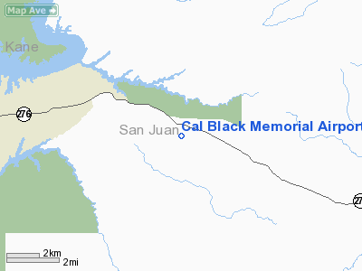
Cal Black Memorial Airport |
Location & QuickFacts
| FAA Information Effective: | 2008-09-25 |
| Airport Identifier: | U96 |
| Airport Status: | Operational |
| Longitude/Latitude: | 110-34-10.5010W/37-26-31.9720N
-110.569584/37.442214 (Estimated) |
| Elevation: | 4388 ft / 1337.46 m (Estimated) |
| Land: | 221 acres |
| From nearest city: | 10 nautical miles E of Halls Crossing, UT |
| Location: | San Juan County, UT |
| Magnetic Variation: | 13E (1990) |
Owner & Manager
| Ownership: | Publicly owned |
| Owner: | San Juan County |
| Address: | 117 S. Main, Po Box 338
Monticello, UT 84535 |
| Phone number: | 435-587-3223 |
| Manager: | Calvin Blake |
| Address: | Hcr Box 330056
Lake Powell, UT 84533-0056 |
| Phone number: | 435-684-2419 |
Airport Operations and Facilities
| Airport Use: | Open to public |
| Wind indicator: | Yes |
| Segmented Circle: | Yes |
| Control Tower: | No |
| Lighting Schedule: | DUSK-DAWN
ACTVT MIRL RY 01/19 AND PAPI RYS 01 AND 19 - CTAF. |
| Beacon Color: | Clear-Green (lighted land airport) |
| Sectional chart: | Denver |
| Region: | ANM - Northwest Mountain |
| Boundary ARTCC: | ZDV - Denver |
| Tie-in FSS: | CDC - Cedar City |
| FSS on Airport: | No |
| FSS Toll Free: | 1-800-WX-BRIEF |
| NOTAMs Facility: | CDC (NOTAM-d service avaliable) |
| Federal Agreements: | N |
Airport Communications
| CTAF: | 123.000 |
| Unicom: | 123.000 |
Airport Services
| Fuel available: | 100LLA |
| Airframe Repair: | NONE |
Runway Information
Runway 01/19
| Dimension: | 5700 x 60 ft / 1737.4 x 18.3 m |
| Surface: | ASPH, Good Condition |
| Weight Limit: | Single wheel: 12500 lbs. |
| Edge Lights: | Medium |
| |
Runway 01 |
Runway 19 |
| Traffic Pattern: | Left | Left |
| Markings: | Basic, Good Condition | Basic, Good Condition |
| VASI: | 2-light PAPI on left side | 2-light PAPI on left side |
| Obstruction: | 5 ft hill, 246.0 ft from runway, 50 ft right of centerline, 9:1 slope to clear | , 50:1 slope to clear |
|
Radio Navigation Aids
| ID |
Type |
Name |
Ch |
Freq |
Var |
Dist |
Remarks
- ACFT IN EXCESS OF 30000 LBS MAX GROSS WEIGHT PROHIBITED FM USING ARPT.
Images and information placed above are from
http://www.airport-data.com/airport/U96/
We thank them for the data!
| General Info
|
| Country |
United States
|
| State |
UTAH
|
| FAA ID |
U96
|
| Latitude |
37-26-31.972N
|
| Longitude |
110-34-10.501W
|
| Elevation |
4388 feet
|
| Near City |
HALLS CROSSING
|
We don't guarantee the information is fresh and accurate. The data may
be wrong or outdated.
For more up-to-date information please refer to other sources.
|
|


