 |
|
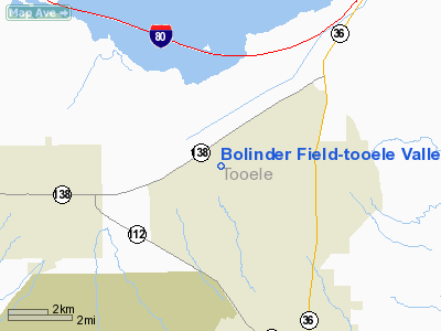
Bolinder Field-tooele Valley Airport |
Tooele Valley Airport
Bolinder Field |
| IATA: none – ICAO: KTVY – FAA LID: TVY |
| Summary |
| Airport type |
Public |
| Owner |
Salt Lake City Department of Airports |
| Serves |
Tooele, Utah |
| Elevation AMSL |
4,322 ft / 1,317 m |
| Coordinates |
40°36′45.2″N 112°21′02.8″W / 40.612556°N 112.350778°W / 40.612556; -112.350778 |
| Website |
www.slcairport.com/... |
| Runways |
| Direction |
Length |
Surface |
| ft |
m |
| 17/35 |
6,100 |
1,859 |
Asphalt |
| Statistics (2009) |
| Aircraft operations |
44,125 |
| Based aircraft |
20 |
| Sources: SLC Dept of Airports, FAA |
Tooele Valley Airport (ICAO: KTVY, FAA LID: TVY), also known as Bolinder Field, is a public use airport in Tooele County, Utah, United States. It is owned by the Salt Lake City Department of Airports and is located five nautical miles (9.26 km) northwest of the central business district of the City of Tooele. According to the FAA's National Plan of Integrated Airport Systems for 2009–2013, it is categorized as a general aviation airport.
Although most U.S. airports use the same three-letter location identifier for the FAA and IATA, this airport is assigned TVY by the FAA but has no designation from the IATA (which assigned TVY to Dawei Airport in Dawei, Myanmar).
Facilities and aircraft
Bolinder Field-Tooele Valley Airport covers an area of 612 acres (248 ha) at an elevation of 4,322 feet (1,317 m) above mean sea level. It has one runway designated 17/35 with an asphalt surface measuring 6,100 by 100 feet (1,859 x 30 m).
For the 12-month period ending May 11, 2008, the airport had 44,125 aircraft operations, an average of 121 per day: 99% general aviation, 1% air taxi and a few ultralights. At that time there were 20 aircraft based at this airport: 90% single-engine, 5% multi-engine and 5% ultralights.
The above content comes from Wikipedia and is published under free licenses – click here to read more.
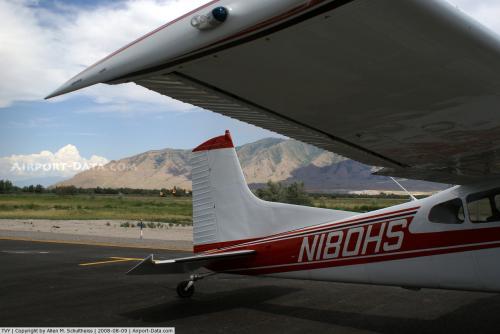 |
(Click on the photo to enlarge) |
Location & QuickFacts
| FAA Information Effective: | 2008-09-25 |
| Airport Identifier: | TVY |
| Airport Status: | Operational |
| Longitude/Latitude: | 112-21-02.8000W/40-36-45.2000N
-112.350778/40.612556 (Estimated) |
| Elevation: | 4321 ft / 1317.04 m (Surveyed) |
| Land: | 541 acres |
| From nearest city: | 5 nautical miles NW of Tooele, UT |
| Location: | Tooele County, UT |
| Magnetic Variation: | 13E (2005) |
Owner & Manager
| Ownership: | Publicly owned |
| Owner: | Salt Lake City Dept Of Airports |
| Address: | Amf Box 22084
Salt Lake City, UT 84122 |
| Phone number: | 801-575-2401 |
| Manager: | Steve Jackson |
| Address: | Amf Box 22084
Salt Lake City, UT 84122 |
| Phone number: | 801-575-2401 |
Airport Operations and Facilities
| Airport Use: | Open to public |
| Wind indicator: | Yes |
| Segmented Circle: | Yes |
| Control Tower: | No |
| Lighting Schedule: | DUSK-DAWN
ACTVT MIRL RY 17/35, REIL RYS 17 & 35, & PAPI RYS 17 & 35 - CTAF. |
| Beacon Color: | Clear-Green (lighted land airport)
BCN OTS INDEFLY. |
| Landing fee charge: | No |
| Sectional chart: | Salt Lake City |
| Region: | ANM - Northwest Mountain |
| Boundary ARTCC: | ZLC - Salt Lake City |
| Tie-in FSS: | CDC - Cedar City |
| FSS on Airport: | No |
| FSS Toll Free: | 1-800-WX-BRIEF |
| NOTAMs Facility: | CDC (NOTAM-d service avaliable) |
| Federal Agreements: | NGY |
Airport Communications
| CTAF: | 123.000 |
| Unicom: | 123.000 |
Airport Services
| Fuel available: | 100LL |
| Airframe Repair: | NONE |
| Power Plant Repair: | NONE |
| Bottled Oxygen: | NONE |
| Bulk Oxygen: | NONE |
Runway Information
Runway 17/35
| Dimension: | 6100 x 100 ft / 1859.3 x 30.5 m |
| Surface: | ASPH, Good Condition |
| Weight Limit: | Single wheel: 30000 lbs. |
| Edge Lights: | Medium |
| |
Runway 17 |
Runway 35 |
| Longitude: | 112-21-03.4093W | 112-21-02.1855W |
| Latitude: | 40-37-15.3276N | 40-36-15.0721N |
| Elevation: | 4273.00 ft | 4321.00 ft |
| Alignment: | 127 | 127 |
| ILS Type: | ILS/DME | |
| Traffic Pattern: | Left | Left |
| Markings: | Non-precision instrument, Good Condition | Basic, Fair Condition |
| Crossing Height: | 45.00 ft | 45.00 ft |
| VASI: | 4-light PAPI on right side | 4-light PAPI on left side |
| Visual Glide Angle: | 3.00° | 3.00° |
| Approach lights: | MALSR
RY 17 MALSR OTS INDEFLY. | |
| Runway End Identifier: | Yes | Yes |
| Centerline Lights: | No | No |
| Touchdown Lights: | No | No |
| Obstruction: | , 50:1 slope to clear | 18 ft road, 1041.0 ft from runway, 46:1 slope to clear |
|
Radio Navigation Aids
| ID |
Type |
Name |
Ch |
Freq |
Var |
Dist |
| TVY | NDB | Tooele | | 371.00 | 13E | 0.2 nm |
| DPG | NDB | Dugway | | 284.00 | 15E | 37.3 nm |
| HIF | TACAN | Hill | 049X | | 14E | 35.2 nm |
| MIJ | TACAN | Michael | 079X | | 15E | 36.4 nm |
| PVU | VOR/DME | Provo | 021X | 108.40 | 15E | 37.4 nm |
| TCH | VORTAC | Wasatch | 115X | 116.80 | 16E | 22.1 nm |
| FFU | VORTAC | Fairfield | 113X | 116.60 | 16E | 27.6 nm |
| OGD | VORTAC | Ogden | 104X | 115.70 | 14E | 38.5 nm |
| SLC | VOT | Salt Lake City | | 111.00 | | 16.4 nm |
Images and information placed above are from
http://www.airport-data.com/airport/TVY/
We thank them for the data!
| General Info
|
| Country |
United States
|
| State |
UTAH
|
| FAA ID |
TVY
|
| Latitude |
40-36-44.181N
|
| Longitude |
112-21-02.779W
|
| Elevation |
4316 feet
|
| Near City |
TOOELE
|
We don't guarantee the information is fresh and accurate. The data may
be wrong or outdated.
For more up-to-date information please refer to other sources.
|
|


