 |
|
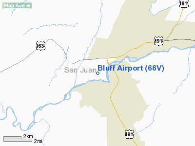
Location & QuickFacts
| FAA Information Effective: | 2008-09-25 |
| Airport Identifier: | 66V |
| Airport Status: | Operational |
| Longitude/Latitude: | 109-38-02.4370W/37-15-00.0030N
-109.634010/37.250001 (Estimated) |
| Elevation: | 4476 ft / 1364.28 m (Estimated) |
| Land: | 72 acres |
| From nearest city: | 4 nautical miles SW of Bluff, UT |
| Location: | San Juan County, UT |
| Magnetic Variation: | 13E (1985) |
Owner & Manager
| Ownership: | Publicly owned |
| Owner: | San Juan Co |
| Address: | 117 S. Main, P.o. Box 338
Monticello, UT 84535 |
| Phone number: | 435-587-3223 |
| Manager: | Jim Hook |
| Address: | Po Box 309
Bluff, UT 84512 |
| Phone number: | 435-672-2281 |
Airport Operations and Facilities
| Airport Use: | Open to public |
| Wind indicator: | Yes |
| Segmented Circle: | No |
| Control Tower: | No |
| Landing fee charge: | No |
| Sectional chart: | Denver |
| Region: | ANM - Northwest Mountain |
| Boundary ARTCC: | ZDV - Denver |
| Tie-in FSS: | CDC - Cedar City |
| FSS on Airport: | No |
| FSS Toll Free: | 1-800-WX-BRIEF |
| NOTAMs Facility: | CDC (NOTAM-d service avaliable) |
Airport Communications
Airport Services
Runway Information
Runway 03/21
| Dimension: | 3000 x 45 ft / 914.4 x 13.7 m |
| Surface: | ASPH, Good Condition |
| |
Runway 03 |
Runway 21 |
| Traffic Pattern: | Left | Left |
| Markings: | Basic, Good Condition | Basic, Good Condition |
| Obstruction: | , 50:1 slope to clear
15 FT ROAD PARALLEL WITH RY 23 LT. | 10 ft hill, 450.0 ft from runway, 10 ft right of centerline, 25:1 slope to clear |
|
Radio Navigation Aids
| ID |
Type |
Name |
Ch |
Freq |
Var |
Dist |
| DVC | VORTAC | Dove Creek | 093X | 114.60 | 14E | 47.4 nm |
Remarks
- 10 FT HILL 450 FT OFF AER 21.
- GRVL PIT 1/4 MILE OFF AER 21.
- ESTABD PRIOR TO 1959.
Images and information placed above are from
http://www.airport-data.com/airport/66V/
We thank them for the data!
| General Info
|
| Country |
United States
|
| State |
UTAH
|
| FAA ID |
66V
|
| Latitude |
37-15-00.003N
|
| Longitude |
109-38-02.437W
|
| Elevation |
4476 feet
|
| Near City |
BLUFF
|
We don't guarantee the information is fresh and accurate. The data may
be wrong or outdated.
For more up-to-date information please refer to other sources.
|
|


