 |
|
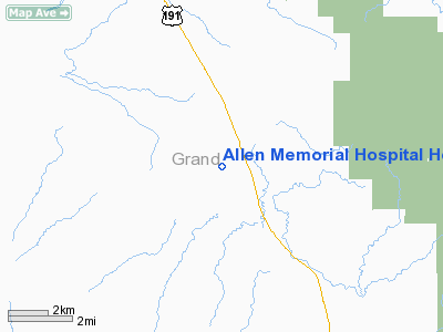
Allen Memorial Hospital Heliport |
Location & QuickFacts
| FAA Information Effective: | 2008-09-25 |
| Airport Identifier: | UT50 |
| Airport Status: | Operational |
| Longitude/Latitude: | 109-45-32.4380W/38-45-50.9150N
-109.759011/38.764143 (Estimated) |
| Elevation: | 3977 ft / 1212.19 m (Estimated) |
| Land: | 0 acres |
| From nearest city: | 0 nautical miles N of Moab, UT |
| Location: | Grand County, UT |
| Magnetic Variation: | 13E (1985) |
Owner & Manager
| Ownership: | Publicly owned |
| Owner: | Grand County |
| Address: | 719 West 4th North
Moab, UT 84532 |
| Phone number: | 801-259-7191 |
| Manager: | Roy Barraclough Adm |
| Address: | 719 West 4th North
Moab, UT 84532 |
| Phone number: | 801-259-7191 |
Airport Operations and Facilities
| Airport Use: | Private
MEDICAL USE. |
| Wind indicator: | Yes |
| Segmented Circle: | No |
| Control Tower: | No |
| Landing fee charge: | No |
| Sectional chart: | Salt Lake City |
| Region: | ANM - Northwest Mountain |
| Boundary ARTCC: | ZDV - Denver |
| Tie-in FSS: | CDC - Cedar City |
| FSS on Airport: | No |
| FSS Toll Free: | 1-800-WX-BRIEF |
Runway Information
Helipad H1
| Dimension: | 80 x 80 ft / 24.4 x 24.4 m |
| Surface: | TURF, |
| |
Runway H1 |
Runway |
| Traffic Pattern: | Left | Left |
|
Radio Navigation Aids
| ID |
Type |
Name |
Ch |
Freq |
Var |
Dist |
| OAB | VOR/DME | Moab | 035X | 109.80 | 15E | 0.7 nm |
| JNC | VORTAC | Grand Junction | 071X | 112.40 | 15E | 48.6 nm |
| HVE | VORTAC | Hanksville | 106X | 115.90 | 15E | 48.9 nm |
Images and information placed above are from
http://www.airport-data.com/airport/UT50/
We thank them for the data!
| General Info
|
| Country |
United States
|
| State |
UTAH
|
| FAA ID |
UT50
|
| Latitude |
38-45-50.915N
|
| Longitude |
109-45-32.438W
|
| Elevation |
3977 feet
|
| Near City |
MOAB
|
We don't guarantee the information is fresh and accurate. The data may
be wrong or outdated.
For more up-to-date information please refer to other sources.
|
|


