 |
|
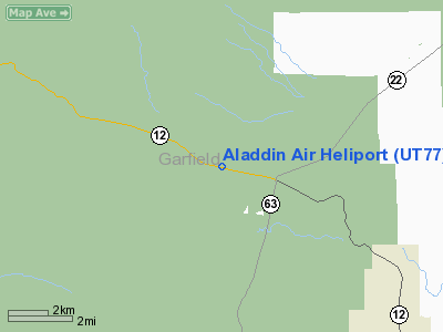
Location & QuickFacts
| FAA Information Effective: | 2008-09-25 |
| Airport Identifier: | UT77 |
| Airport Status: | Operational |
| Longitude/Latitude: | 112-10-57.0000W/37-41-54.0000N
-112.182500/37.698333 (Estimated) |
| Elevation: | 7540 ft / 2298.19 m (Estimated) |
| Land: | 0 acres |
| From nearest city: | 7 nautical miles E of Tropic, UT |
| Location: | Garfield County, UT |
| Magnetic Variation: | 11E (1995) |
Owner & Manager
| Ownership: | Privately owned |
| Owner: | Terry Andrews & Susan Rogers |
| Address: | 1260 W Highway 12 Po Box 2
Panguitch, UT 84759 |
| Phone number: | 435-834-5555 |
| Manager: | Susan Rogers |
| Address: | Po Box 2
Panguitch, UT 84759 |
| Phone number: | 435-834-5555 |
Airport Operations and Facilities
| Airport Use: | Private |
| Wind indicator: | Yes |
| Segmented Circle: | No |
| Control Tower: | No |
| Sectional chart: | Las Vegas |
| Region: | ANM - Northwest Mountain |
| Boundary ARTCC: | ZLC - Salt Lake City |
| Tie-in FSS: | CDC - Cedar City |
| FSS on Airport: | No |
| FSS Toll Free: | 1-800-WX-BRIEF |
Runway Information
Helipad H1
| Dimension: | 30 x 30 ft / 9.1 x 9.1 m |
| Surface: | CONC, |
| |
Runway H1 |
Runway |
| Traffic Pattern: | Left | Left |
|
Radio Navigation Aids
| ID |
Type |
Name |
Ch |
Freq |
Var |
Dist |
| CDC | VOR/DME | Cedar City | 120X | 117.30 | 16E | 42.4 nm |
| BCE | VORTAC | Bryce Canyon | 075X | 112.80 | 15E | 5.8 nm |
Images and information placed above are from
http://www.airport-data.com/airport/UT77/
We thank them for the data!
| General Info
|
| Country |
United States
|
| State |
UTAH
|
| FAA ID |
UT77
|
| Latitude |
37-41-54.000N
|
| Longitude |
112-10-57.000W
|
| Elevation |
7540 feet
|
| Near City |
TROPIC
|
We don't guarantee the information is fresh and accurate. The data may
be wrong or outdated.
For more up-to-date information please refer to other sources.
|
|


