 |
|
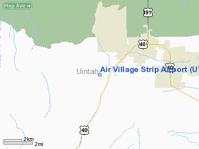
Air Village Strip Airport |
Location & QuickFacts
| FAA Information Effective: | 2008-09-25 |
| Airport Identifier: | UT07 |
| Airport Status: | Operational |
| Longitude/Latitude: | 109-35-32.5000W/40-25-29.8560N
-109.592361/40.424960 (Estimated) |
| Elevation: | 5800 ft / 1767.84 m (Estimated) |
| Land: | 18 acres |
| From nearest city: | 3 nautical miles SW of Vernal, UT |
| Location: | Uintah County, UT |
| Magnetic Variation: | 14E (1985) |
Owner & Manager
| Ownership: | Privately owned |
| Owner: | General Properties Inc |
| Address: | 2750 W. Highway 40
Vernal, UT 84078 |
| Phone number: | 801-789-3284 |
| Manager: | Lyle Mc Keachnie |
| Address: | 2750 W. Highway 40
Vernal, UT 84078 |
| Phone number: | 801-789-3284 |
Airport Operations and Facilities
| Airport Use: | Private |
| Wind indicator: | No |
| Segmented Circle: | No |
| Control Tower: | No |
| Landing fee charge: | Yes |
| Sectional chart: | Salt Lake City |
| Region: | ANM - Northwest Mountain |
| Boundary ARTCC: | ZLC - Salt Lake City |
| Tie-in FSS: | CDC - Cedar City |
| FSS on Airport: | No |
| FSS Toll Free: | 1-800-WX-BRIEF |
Airport Services
| Airframe Repair: | NONE |
| Power Plant Repair: | NONE |
Runway Information
Runway NW/SE
| Dimension: | 3960 x 100 ft / 1207.0 x 30.5 m |
| Surface: | TURF, |
| |
Runway NW |
Runway SE |
| Traffic Pattern: | Left | Left |
|
Radio Navigation Aids
| ID |
Type |
Name |
Ch |
Freq |
Var |
Dist |
| VEL | VOR/DME | Vernal | 019X | 108.20 | 15E | 5.3 nm |
| MTU | VORTAC | Myton | 074X | 112.70 | 14E | 29.6 nm |
Images and information placed above are from
http://www.airport-data.com/airport/UT07/
We thank them for the data!
| General Info
|
| Country |
United States
|
| State |
UTAH
|
| FAA ID |
UT07
|
| Latitude |
40-25-29.856N
|
| Longitude |
109-35-32.500W
|
| Elevation |
5800 feet
|
| Near City |
VERNAL
|
We don't guarantee the information is fresh and accurate. The data may
be wrong or outdated.
For more up-to-date information please refer to other sources.
|
|


