 |
|
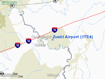
Location & QuickFacts
| FAA Information Effective: | 2008-09-25 |
| Airport Identifier: | 1TE4 |
| Airport Status: | Operational |
| Longitude/Latitude: | 098-09-28.0320W/29-29-43.8330N
-98.157787/29.495509 (Estimated) |
| Elevation: | 592 ft / 180.44 m (Estimated) |
| Land: | 230 acres |
| From nearest city: | 4 nautical miles S of Marion, TX |
| Location: | Guadalupe County, TX |
| Magnetic Variation: | 07E (1985) |
Owner & Manager
| Ownership: | Privately owned |
| Owner: | Zuehl Apt Flying Comm Ownrs Assn |
| Address: | P.o. Box 430
Marion, TX 78124 |
| Phone number: | 830-914-4043 |
| Manager: | Zuehl Arpt Flying Comm Ownrs Assn |
| Address: | P.o. Box 430
Marion, TX 78124 |
| Phone number: | 830-914-4043 |
Airport Operations and Facilities
| Airport Use: | Private |
| Wind indicator: | Yes |
| Segmented Circle: | No |
| Control Tower: | No |
| Landing fee charge: | No |
| Sectional chart: | San Antonio |
| Region: | ASW - Southwest |
| Boundary ARTCC: | ZHU - Houston |
| Tie-in FSS: | SJT - San Angelo |
| FSS on Airport: | No |
| FSS Toll Free: | 1-800-WX-BRIEF |
Airport Services
| Fuel available: | 100 |
| Airframe Repair: | NONE |
| Power Plant Repair: | NONE |
Runway Information
Runway 17/35
| Dimension: | 3000 x 200 ft / 914.4 x 61.0 m |
| Surface: | TURF, |
| |
Runway 17 |
Runway 35 |
| Traffic Pattern: | Left | Right |
| Runway End Identifier: | No | No |
| Centerline Lights: | No | No |
| Touchdown Lights: | No | No |
|
Radio Navigation Aids
| ID |
Type |
Name |
Ch |
Freq |
Var |
Dist |
| CVB | NDB | Castroville | | 338.00 | 08E | 37.3 nm |
| PEZ | NDB | Pleasanton | | 275.00 | 07E | 37.6 nm |
| HHH | NDB | Devine | | 359.00 | 07E | 46.2 nm |
| DHK | TACAN | Randolph | 036X | | 09E | 6.3 nm |
| KSY | TACAN | Kelly | 057X | | 07E | 23.0 nm |
| SSF | VOR | Stinson | | 108.40 | 09E | 20.7 nm |
| RND | VORTAC | Randolph | 70X | 112.30 | 09E | 6.8 nm |
| SAT | VORTAC | San Antonio | 115X | 116.80 | 08E | 18.2 nm |
| SAT | VOT | San Antonio Intl | | 110.40 | | 16.5 nm |
Remarks
- ACFT WINGSPAN LIMITED TO 60 FEET.
- ARPT LOCATED IN CLOSE PROXIMITY TO RANDOLPH AFB.
- DUE TO CLOSE PROXIMITY OF RANDOLPH AFB & THAT COMPATIBLE TFC PATTERNS CANNOT BE ESTABLISHED.
Images and information placed above are from
http://www.airport-data.com/airport/1TE4/
We thank them for the data!
| General Info
|
| Country |
United States
|
| State |
TEXAS
|
| FAA ID |
1TE4
|
| Latitude |
29-29-43.833N
|
| Longitude |
098-09-28.032W
|
| Elevation |
592 feet
|
| Near City |
MARION
|
We don't guarantee the information is fresh and accurate. The data may
be wrong or outdated.
For more up-to-date information please refer to other sources.
|
|


