 |
|
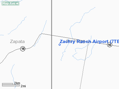
Location & QuickFacts
| FAA Information Effective: | 2008-09-25 |
| Airport Identifier: | 7TE1 |
| Airport Status: | Operational |
| Longitude/Latitude: | 098-56-19.1050W/27-04-21.1460N
-98.938640/27.072541 (Estimated) |
| Elevation: | 592 ft / 180.44 m (Surveyed) |
| Land: | 0 acres |
| From nearest city: | 5 nautical miles E of Escobas, TX |
| Location: | Jim Hogg County, TX |
| Magnetic Variation: | 07E (1985) |
Owner & Manager
| Ownership: | Privately owned |
| Owner: | H.b.zachry Co. |
| Address: | Po Box 21130
San Antonio, TX 78221 |
| Manager: | Byron Reed |
| Address: | 10226 John Cape Rd
San Antonio, TX 78216 |
| Phone number: | 512-828-1868 |
Airport Operations and Facilities
| Airport Use: | Private |
| Wind indicator: | No |
| Segmented Circle: | No |
| Control Tower: | No |
| Landing fee charge: | No |
| Sectional chart: | Brownsville |
| Region: | ASW - Southwest |
| Boundary ARTCC: | ZHU - Houston |
| Tie-in FSS: | SJT - San Angelo |
| FSS on Airport: | No |
| FSS Toll Free: | 1-800-WX-BRIEF |
Runway Information
Runway 17/35
| Dimension: | 5000 x 75 ft / 1524.0 x 22.9 m |
| Surface: | ASPH, |
| |
Runway 17 |
Runway 35 |
| Traffic Pattern: | Left | Left |
|
Radio Navigation Aids
| ID |
Type |
Name |
Ch |
Freq |
Var |
Dist |
| HBV | NDB | Hebbronville | | 266.00 | 06E | 19.9 nm |
| SNE | NDB | Santa Elena | | 260.00 | 07E | 28.8 nm |
| BKS | NDB | Brooks County | | 353.00 | 06E | 44.4 nm |
| NLD | VOR/DME | Nuevo Laredo | 073X | 112.60 | 09E | 40.0 nm |
| LRD | VORTAC | Laredo | 121X | 117.40 | 09E | 35.4 nm |
Remarks
Images and information placed above are from
http://www.airport-data.com/airport/7TE1/
We thank them for the data!
| General Info
|
| Country |
United States
|
| State |
TEXAS
|
| FAA ID |
7TE1
|
| Latitude |
27-04-21.146N
|
| Longitude |
098-56-19.105W
|
| Elevation |
592 feet
|
| Near City |
ESCOBAS
|
We don't guarantee the information is fresh and accurate. The data may
be wrong or outdated.
For more up-to-date information please refer to other sources.
|
|


