 |
|
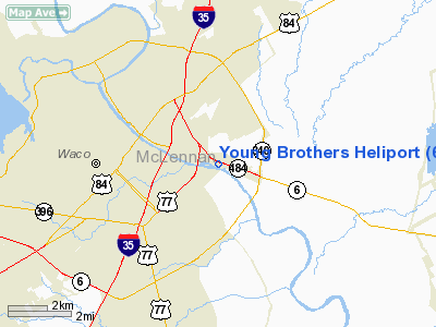
Location & QuickFacts
| FAA Information Effective: | 2008-09-25 |
| Airport Identifier: | 60XS |
| Airport Status: | Operational |
| Longitude/Latitude: | 097-05-29.0000W/31-33-08.6000N
-97.091389/31.552389 (Estimated) |
| Elevation: | 412 ft / 125.58 m (Estimated) |
| Land: | 0 acres |
| From nearest city: | 7 nautical miles NW of Waco, TX |
| Location: | Mc Lennan County, TX |
| Magnetic Variation: | 07E (1985) |
Owner & Manager
| Ownership: | Privately owned |
| Owner: | Young Equipment Company |
| Address: | Po Drawer 1800
Waco, TX 76703 |
| Phone number: | 817-754-2324 |
| Manager: | Phil Little |
| Address: | Po Drawer 1800
Waco, TX 76703 |
| Phone number: | 817-754-2324 |
Airport Operations and Facilities
| Airport Use: | Private |
| Wind indicator: | Yes |
| Segmented Circle: | No |
| Control Tower: | No |
| Lighting Schedule: | PHONE REQ
FOR LGTS, PHONE 817-754-2324. |
| Landing fee charge: | No |
| Sectional chart: | San Antonio |
| Region: | ASW - Southwest |
| Boundary ARTCC: | ZFW - Fort Worth |
| Tie-in FSS: | FTW - Fort Worth |
| FSS on Airport: | No |
| FSS Phone: | 817-541-3474 |
| FSS Toll Free: | 1-800-WX-BRIEF |
Runway Information
Helipad H1
| Dimension: | 12 x 10 ft / 3.7 x 3.0 m
44 FT BY 86 FT LNDG & TKOF AREA. |
| Surface: | MATS,
ROOFTOP HELIPAD. |
| |
Runway H1 |
Runway |
| Traffic Pattern: | Left | Left |
|
Radio Navigation Aids
| ID |
Type |
Name |
Ch |
Freq |
Var |
Dist |
| ROB | NDB | Robinson | | 400.00 | 07E | 3.1 nm |
| LXY | NDB | Mexia | | 329.00 | 07E | 30.1 nm |
| HLR | NDB | Hood | | 347.00 | 07E | 40.8 nm |
| IL | NDB | Iresh | | 278.00 | 07E | 44.9 nm |
| CRS | NDB | Corsicana | | 396.00 | 06E | 45.6 nm |
| CGQ | NDB | Powell | | 344.00 | 06E | 45.8 nm |
| GR | NDB | Starn | | 323.00 | 07E | 46.5 nm |
| PYF | NDB | Pyramid | | 418.00 | 06E | 49.4 nm |
| TPL | VOR/DME | Temple | 041X | 110.40 | 09E | 26.8 nm |
| GNL | VOR/DME | Groesbeck | 025X | 108.80 | 05E | 27.8 nm |
| GRK | VOR/DME | Gray | 055X | 111.80 | 07E | 48.5 nm |
| ACT | VORTAC | Waco | 100X | 115.30 | 09E | 11.2 nm |
Remarks
Images and information placed above are from
http://www.airport-data.com/airport/60XS/
We thank them for the data!
| General Info
|
| Country |
United States
|
| State |
TEXAS
|
| FAA ID |
60XS
|
| Latitude |
31-33-08.600N
|
| Longitude |
097-05-29.000W
|
| Elevation |
412 feet
|
| Near City |
WACO
|
We don't guarantee the information is fresh and accurate. The data may
be wrong or outdated.
For more up-to-date information please refer to other sources.
|
|


