 |
|
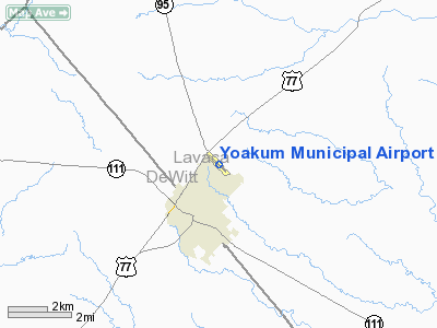
Location & QuickFacts
| FAA Information Effective: | 2008-09-25 |
| Airport Identifier: | T85 |
| Airport Status: | Operational |
| Longitude/Latitude: | 097-08-18.3000W/29-18-47.4000N
-97.138417/29.313167 (Estimated) |
| Elevation: | 365 ft / 111.25 m (Surveyed) |
| Land: | 92 acres |
| From nearest city: | 1 nautical miles N of Yoakum, TX |
| Location: | Lavaca County, TX |
| Magnetic Variation: | 06E (1995) |
Owner & Manager
| Ownership: | Publicly owned |
| Owner: | City Of Yoakum |
| Address: | Po Box 738
Yoakum, TX 77995 |
| Phone number: | 361-293-5682 |
| Manager: | Derrick Smith
DIRECTOR OF COMMUNITY SERVICES. |
| Address: | Po Box 738
Yoakum, TX 77995-0738 |
| Phone number: | 361-293-5682 |
Airport Operations and Facilities
| Airport Use: | Open to public |
| Wind indicator: | Yes |
| Segmented Circle: | Yes |
| Control Tower: | No |
| Lighting Schedule: | DUSK-DAWN
ACTVT MIRL RY 13/31 - CTAF. |
| Beacon Color: | Clear-Green (lighted land airport) |
| Landing fee charge: | No |
| Sectional chart: | San Antonio |
| Region: | ASW - Southwest |
| Boundary ARTCC: | ZHU - Houston |
| Tie-in FSS: | CXO - Montgomery County |
| FSS on Airport: | No |
| FSS Toll Free: | 1-800-WX-BRIEF
FOR FP FILING CALL CXO FSS 1-800-992-7433. |
| NOTAMs Facility: | CXO (NOTAM-d service avaliable) |
| Federal Agreements: | Y1 |
Airport Communications
Airport Services
Runway Information
Runway 13/31
| Dimension: | 3445 x 60 ft / 1050.0 x 18.3 m |
| Surface: | ASPH, Good Condition |
| Weight Limit: | Single wheel: 12000 lbs. |
| Edge Lights: | Medium |
| |
Runway 13 |
Runway 31 |
| Longitude: | 097-08-32.2093W | 097-08-04.2980W |
| Latitude: | 29-18-59.2858N | 29-18-35.5299N |
| Elevation: | 365.00 ft | 341.00 ft |
| Alignment: | 127 | 127 |
| Traffic Pattern: | Left | Left |
| Markings: | Non-precision instrument, Good Condition | Non-precision instrument, Good Condition |
| Obstruction: | 34 ft pole, 1105.0 ft from runway, 87 ft left of centerline, 26:1 slope to clear | 36 ft pole, 1200.0 ft from runway, 205 ft right of centerline, 27:1 slope to clear |
|
Radio Navigation Aids
| ID |
Type |
Name |
Ch |
Freq |
Var |
Dist |
| PKV | NDB | Port Lavaca | | 515.00 | 05E | 46.5 nm |
| VCT | VOR/DME | Victoria | 027X | 109.00 | 06E | 26.2 nm |
| ELA | VOR/DME | Eagle Lake | 111X | 116.40 | 08E | 47.8 nm |
| IDU | VORTAC | Industry | 039X | 110.20 | 08E | 49.0 nm |
Images and information placed above are from
http://www.airport-data.com/airport/T85/
We thank them for the data!
| General Info
|
| Country |
United States
|
| State |
TEXAS
|
| FAA ID |
T85
|
| Latitude |
29-18-47.385N
|
| Longitude |
097-08-18.250W
|
| Elevation |
365 feet
|
| Near City |
YOAKUM
|
We don't guarantee the information is fresh and accurate. The data may
be wrong or outdated.
For more up-to-date information please refer to other sources.
|
|


