 |
|
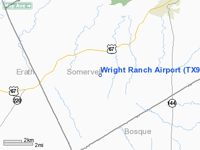
Location & QuickFacts
| FAA Information Effective: | 2008-09-25 |
| Airport Identifier: | TX93 |
| Airport Status: | Operational |
| Longitude/Latitude: | 097-50-01.1080W/32-10-00.5190N
-97.833641/32.166811 (Estimated) |
| Elevation: | 900 ft / 274.32 m (Estimated) |
| Land: | 0 acres |
| From nearest city: | 3 nautical miles SW of Glen Rose, TX |
| Location: | Somervell County, TX |
| Magnetic Variation: | 07E (1985) |
Owner & Manager
| Ownership: | Privately owned |
| Owner: | Linley S Wright |
| Address: | Po Box 784
Glen Rose, TX 76043 |
| Phone number: | 817-897-4272 |
| Address: |
|
Airport Operations and Facilities
| Airport Use: | Private |
| Wind indicator: | Yes |
| Segmented Circle: | No |
| Control Tower: | No |
| Landing fee charge: | No |
| Sectional chart: | Dallas-ft Worth |
| Region: | ASW - Southwest |
| Boundary ARTCC: | ZFW - Fort Worth |
| Tie-in FSS: | FTW - Fort Worth |
| FSS on Airport: | No |
| FSS Phone: | 817-541-3474 |
| FSS Toll Free: | 1-800-WX-BRIEF |
Airport Services
| Airframe Repair: | NONE |
| Power Plant Repair: | NONE |
Runway Information
Runway 15/33
| Dimension: | 1600 x 50 ft / 487.7 x 15.2 m |
| Surface: | TURF, |
| |
Runway 15 |
Runway 33 |
| Traffic Pattern: | Left | Left |
| Obstruction: | | 50 ft trees, 0.0 ft from runway |
|
Runway 18/36
| Dimension: | 3700 x 100 ft / 1127.8 x 30.5 m |
| Surface: | TURF, |
| |
Runway 18 |
Runway 36 |
| Traffic Pattern: | Left | Left |
| Obstruction: | | 50 ft trees pline, 0.0 ft from runway |
|
Radio Navigation Aids
| ID |
Type |
Name |
Ch |
Freq |
Var |
Dist |
| MNZ | NDB | Hamilton | | 251.00 | 07E | 36.6 nm |
| MWL | NDB | Mineral Wells | | 266.00 | 06E | 38.9 nm |
| NFW | TACAN | Nas Jrb Fort Worth | 024X | | 07E | 41.5 nm |
| JEN | VORTAC | Glen Rose | 097X | 115.00 | 06E | 2.3 nm |
| MQP | VORTAC | Millsap | 124X | 117.70 | 09E | 34.6 nm |
| ACT | VORTAC | Waco | 100X | 115.30 | 09E | 41.8 nm |
| FTW | VOT | Fort Worth Meacham | | 108.20 | | 45.9 nm |
Remarks
Images and information placed above are from
http://www.airport-data.com/airport/TX93/
We thank them for the data!
| General Info
|
| Country |
United States
|
| State |
TEXAS
|
| FAA ID |
TX93
|
| Latitude |
32-10-00.519N
|
| Longitude |
097-50-01.108W
|
| Elevation |
900 feet
|
| Near City |
GLEN ROSE
|
We don't guarantee the information is fresh and accurate. The data may
be wrong or outdated.
For more up-to-date information please refer to other sources.
|
|


